What would the territorial boundaries of the Arctic look like if all countries with Arctic coastlines claimed their continental shelves?
How can understanding undersea geology increase the land mass of an Arctic nation?
Activity Instructions
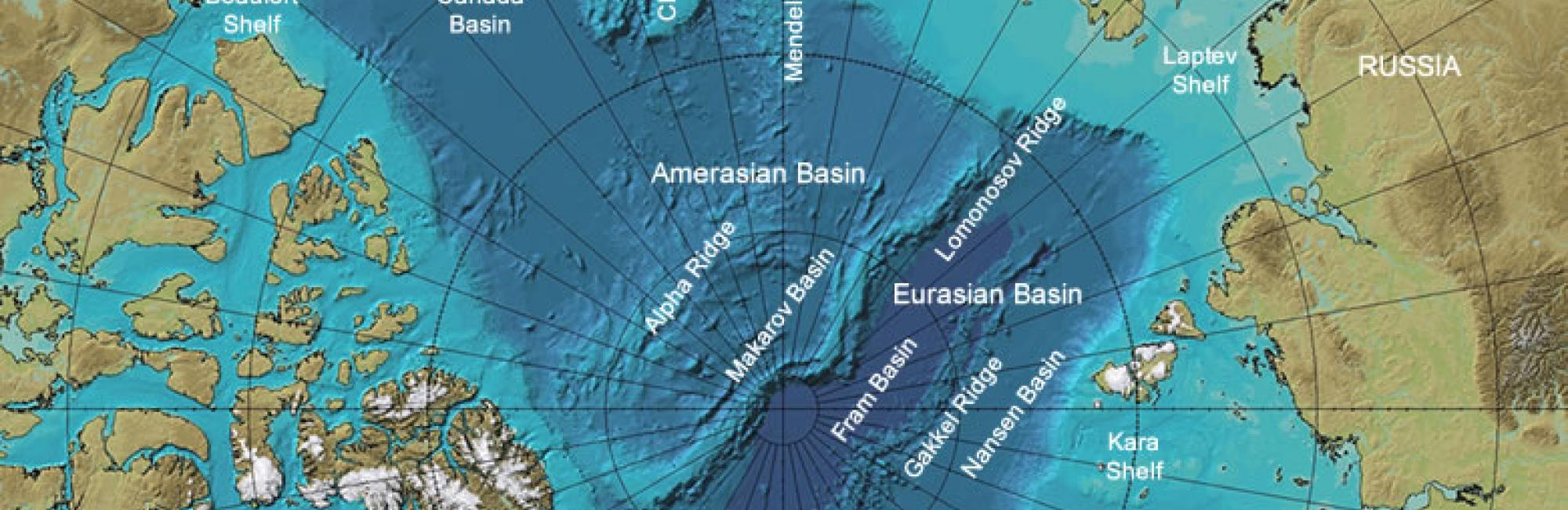
1. Give each student a copy of the International Bathymetric Map of the Arctic Ocean. Explain the 'bathymetry' means depth below sea level. Ask them to describe what they notice. Students should see that the seafloor extending out from the continents is shallower than the middle of the Arctic Ocean.
2. Define the shallow seafloor extending out from the continents as the continental shelf. A continental shelf is an underwater portion of a continent that was often exposed in earlier geologic periods when sea level was lower because there were more glaciers and ice sheets on land. Show your students a side view diagram of a continental shelf.
3. Explain to students the concept of an exclusive economic zone (EEZ): The EEZ of a coastal nation is the region extending 200 nautical miles (370 km) offshore from a nation's shoreline or other baseline. A nation has rights to the management and use of marine resources in the water column and on the seafloor within its EEZ.
4. Explain to students that coastal nations can also claim rights to the seafloor of their continental shelf. Instruct students to write and draw on their map to delineate both the EEZ of each Arctic nation as well as their additional seafloor claims from their continental shelves.
5. Discuss: What do you notice? Do you see any potential for conflicts on territorial claims in the Arctic?