Parting Ways in the Arctic
Back to the Floe
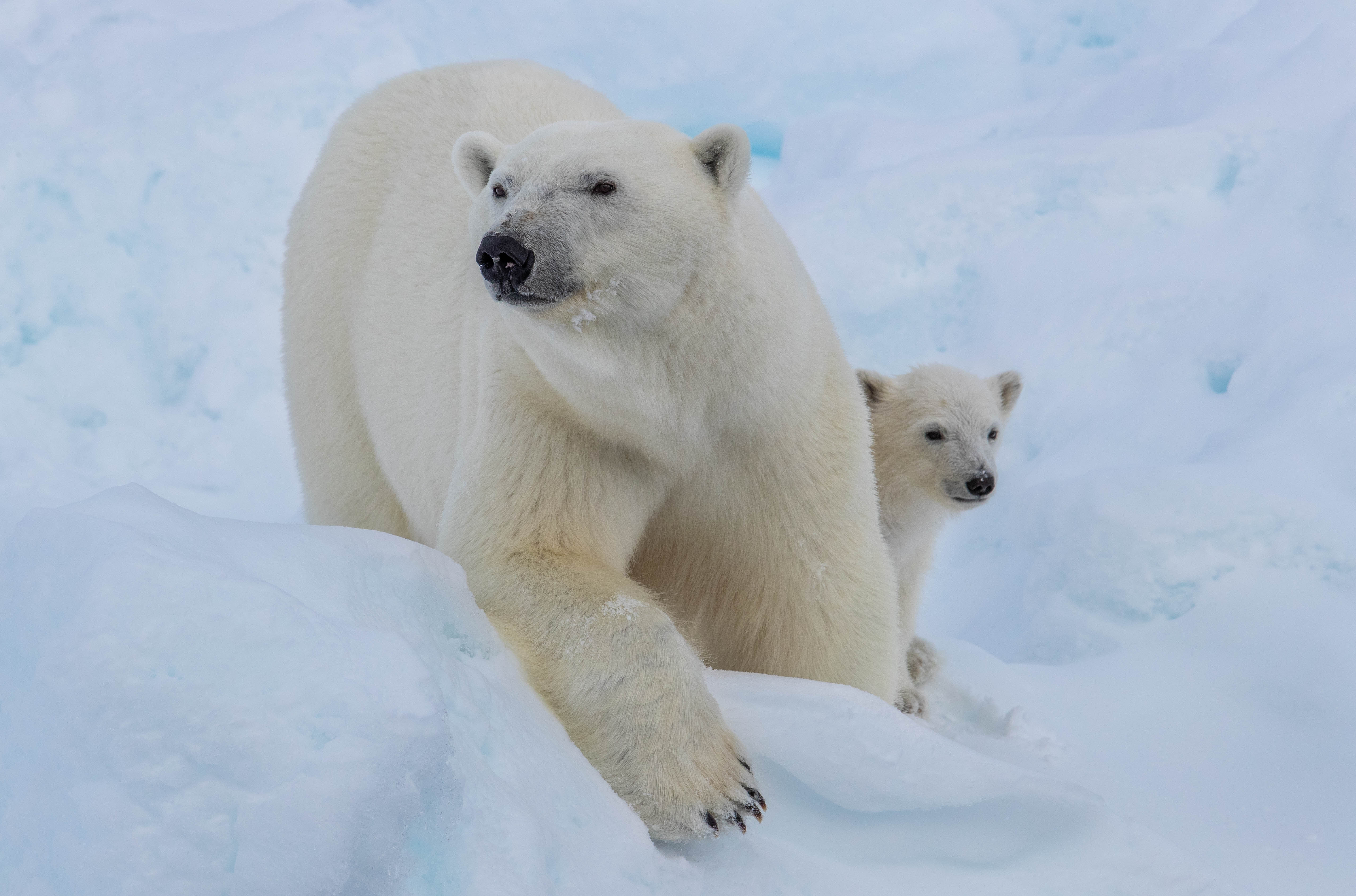
The Polarstern is headed back into the Arctic sea ice with leg 4 participants to continue the mission of the MOSAiC expedition. There have been a variety of wildlife sightings along the way: seals and polar cod have been observed near the ocean surface, brown and green algae dot melt ponds on the ice, and seagulls are near constant companions of the ship. There was even a minke whale (smallest of the baleen whales) that surfaced between large pieces of ice! But perhaps the highlight of the wildlife sightings for Polarstern passengers was a mother polar bear and her spring cub who spent a few hours checking out the ship as it waited for a gap to open up in the thick ice. Photo credit: Lianna Nixon
How are polar bears being monitored in Arctic regions? In some places...drones!
Home, Sweet Home
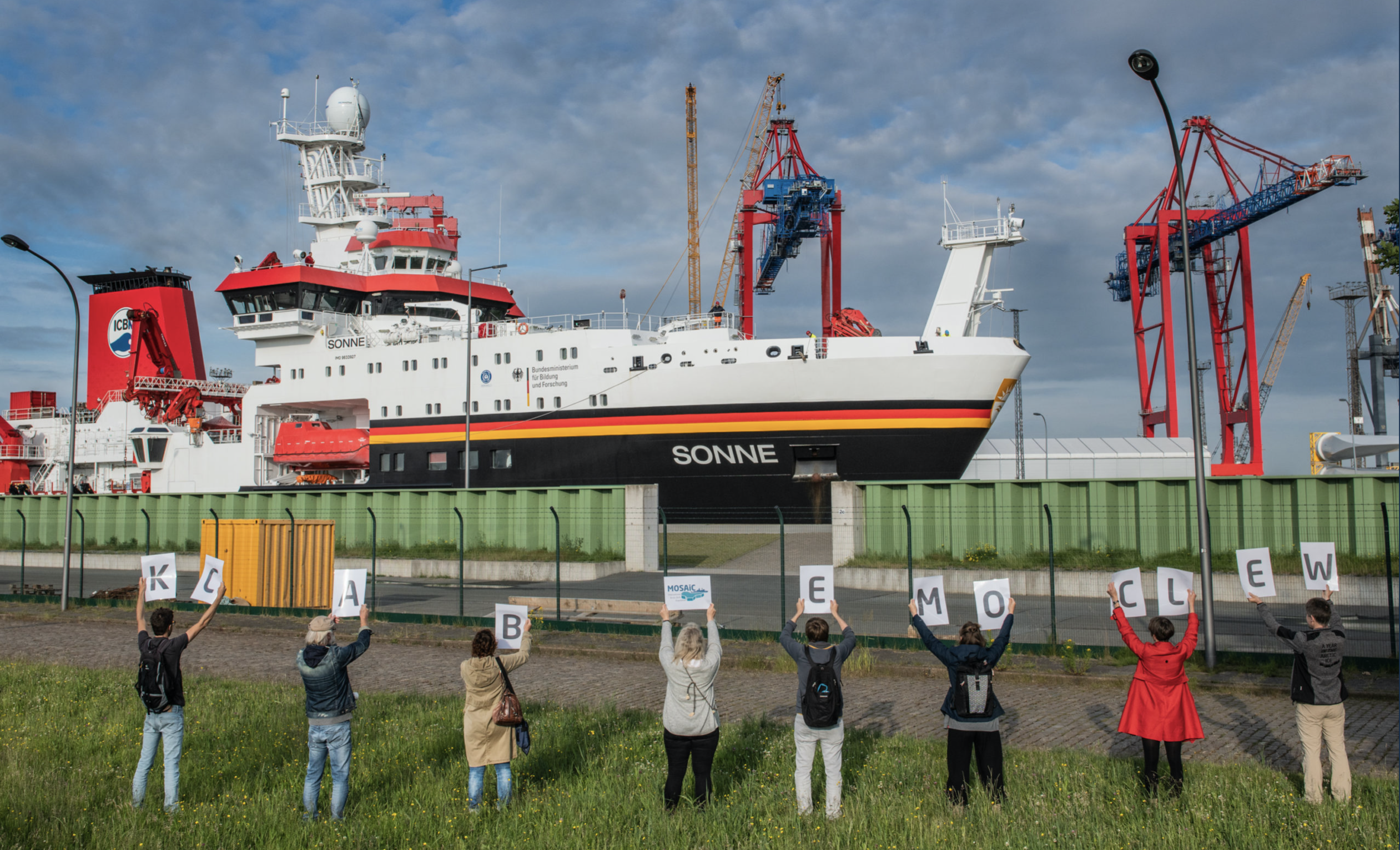
Meanwhile, after more than 140 days away from home, MOSAiC leg 3 participants finally returned to land in Bremerhaven, Germany aboard the Maria S. Merian and Sonne. They return to a world that experienced significant changes while they were in the middle of the remote Arctic. For perspective, consider this: Leg 3 team members initially arrived in the Central Arctic Ocean at the end of February when there was still 24 hours of darkness. They have returned back to land just in time for the Northern Hemisphere summer solstice (June 20th), the longest day of the year for folks living north of the equator. And leg 4 team members are on board the Polarstern heading back into 24 hours of daylight! Photo credit: Esther Horvath
Watch the video: What is a solstice?
Local Observations and Indigenous Knowledge in the Arctic
While scientific research expeditions like MOSAiC are important for collecting data to better understand how the Arctic region is changing, indigenous peoples who call the Arctic their home and have an intimate connection to the region have been making observations of environmental change for decades, and have been building up a knowledge base of the region for millennia. Here, we want to highlight some projects and efforts designed to preserve, compile, and share this invaluable indigenous knowledge.
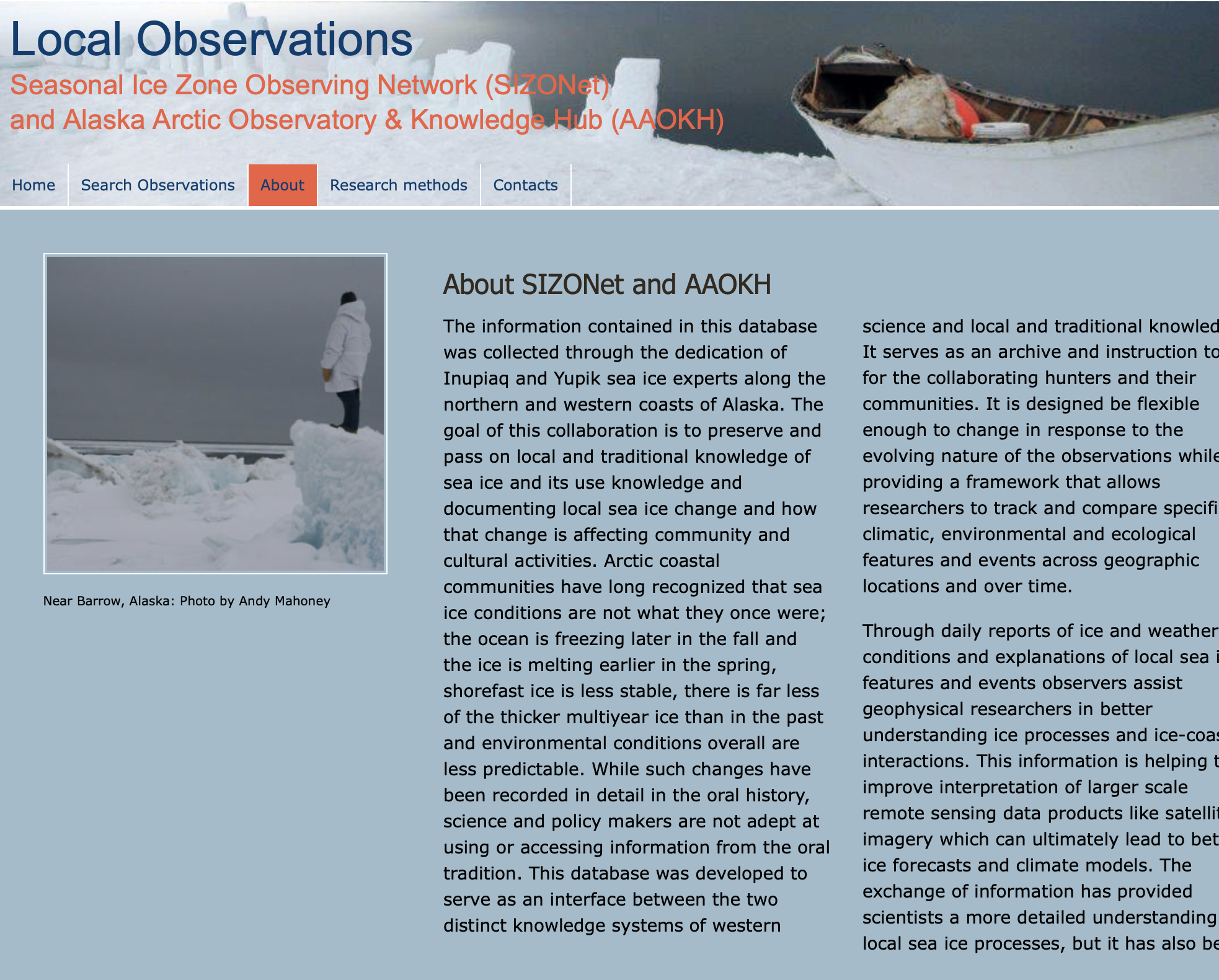
Seasonal Ice Zone Observing Network (SIZONet) & Alaska Arctic Observatory & Knowledge Hub (AAOKH)
The information contained in this database was collected through the dedication of Inupiaq and Yupik sea ice experts along the northern and western coasts of Alaska. The goal of this collaboration is to preserve and pass on local and traditional knowledge of sea ice and its use knowledge and documenting local sea ice change and how that change is affecting community and cultural activities. (This text is directly from the SIZONet/AAOKH website)
Learn more about SIZONet & AAOKH
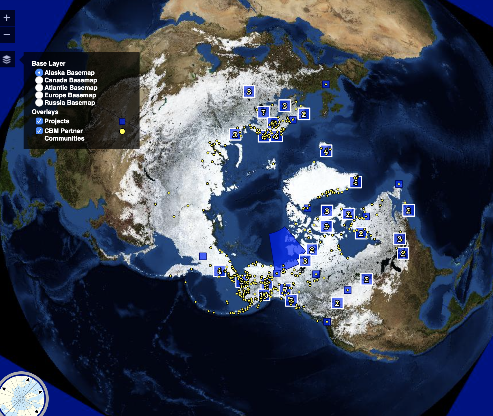
Atlas of Community-Based Monitoring & Indigenous Knowledge in a Changing Arctic
The Atlas of Community-Based Monitoring in a Changing Arctic was initiated to address a gap in the coordination of community-based monitoring initiatives in the circumpolar region. Community-based monitoring happens with the people in a community directly oversee the services being provided to them. It is based on the idea that local residents have a better understanding of their community's needs and a higher stake in making sure these needs are met adequately and efficiently than outside service providers do. A key goal of the Atlas of Community-Based Monitoring in a Changing Arctic is to connect communities around the Arctic region so that they can share their CBM approaches and consider them in a broader circumpolar context.
Learn more about the Atlas of Community-Based Monitoring in a Changing Arctic project
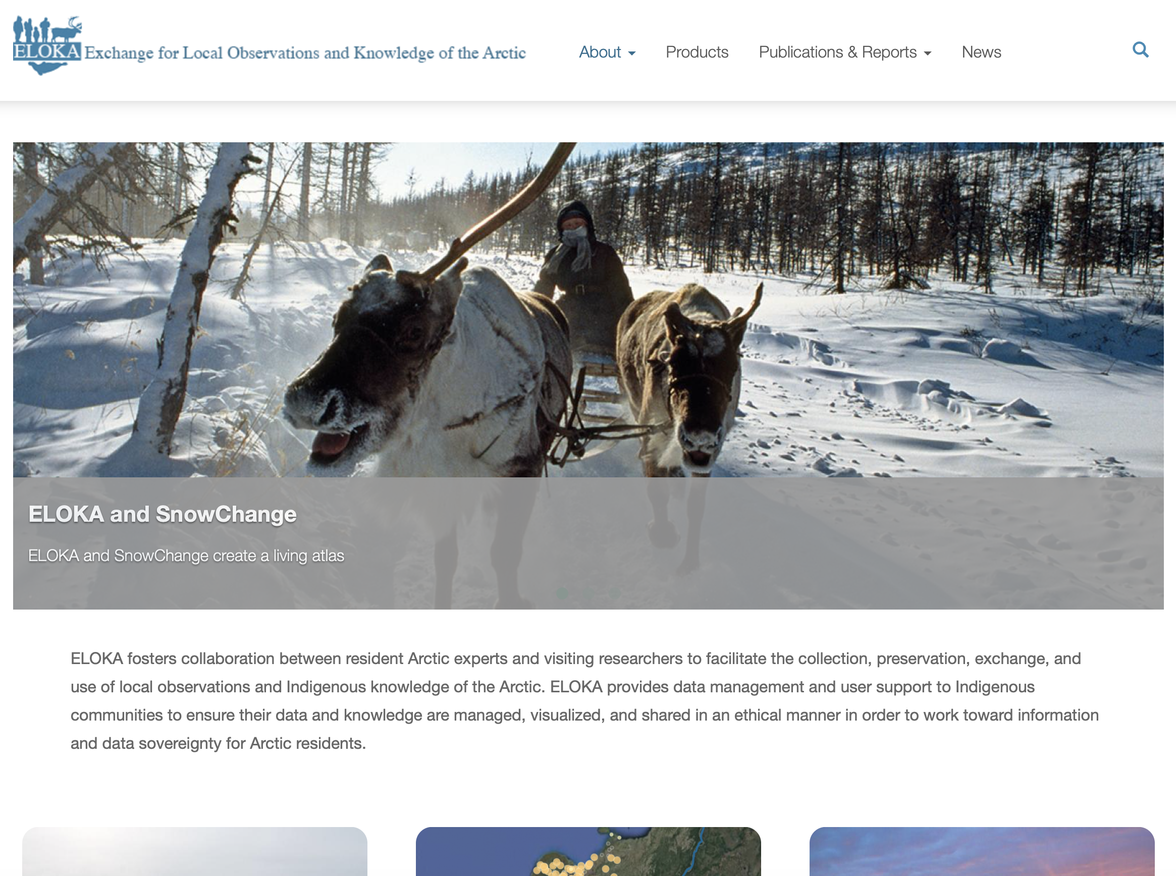
Exchange for Local Observations and Knowledge of the Arctic (ELOKA)
ELOKA partners with Indigenous communities in the Arctic to create online products that facilitate the collection, preservation, exchange, and use of local observations and Indigenous Knowledge of the Arctic. ELOKA fosters collaboration between resident Arctic experts and visiting researchers, provides data management and user support, and develops digital tools for Indigenous Knowledge in collaboration with their partners. By working together, Arctic residents and researchers can make significant contributions to a deeper understanding of the Arctic and the social and environmental changes ongoing in the region. (This text is directly from the ELOKA website)
Do you have a project or initiative to share that raises indigenous voices in the Arctic? Email us: mosaic@colorado.edu
 #askmosaic: It'a a Bird, It's a Crane
Everett and Emmett from Double Eagle Elementary School in Albuquerque want to know: What's the giant red thing on the front of the ship?
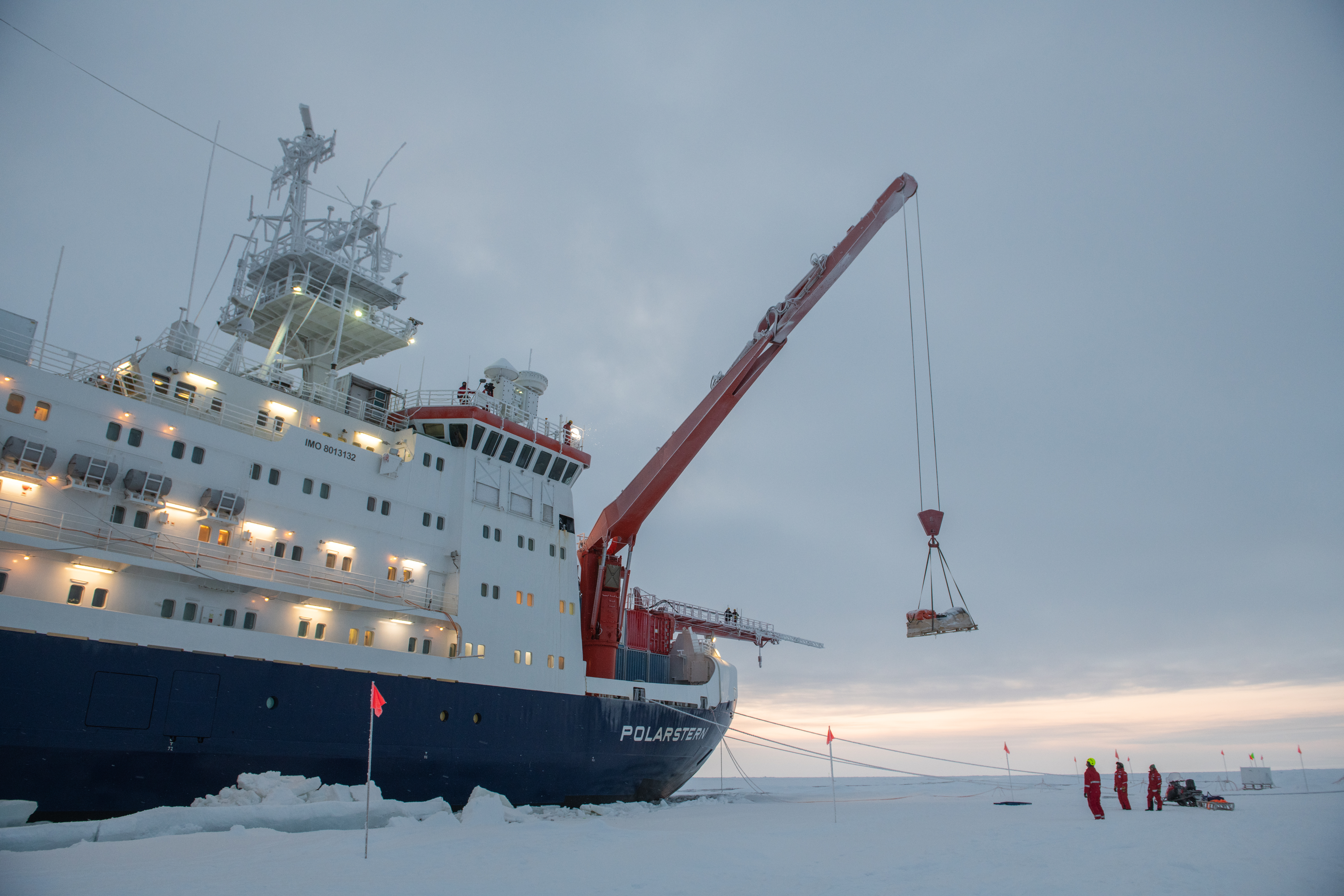
"This is the bow crane, which can lift up to 25 tons. This crane is large enough to put regular containers on the bow of the ship or even on the uppermost deck. For example, during MOSAiC the bow area (front of the ship) is equipped with 20 containers that have been lifted to their current position with the crane. The majority of these containers are equipped with a huge number of scientific instruments to measure continuously hundreds of parameters to characterize the atmospheric state and composition."
-Hans-Werner Jacobi, CNRS & University Grenoble Alpes, France
In this photo taken by Esther Horvath during the first leg of MOSAiC, you can see the bow crane lifting equipment onto the ice.
Send us your #askmosaic questions!
 This week's featured remote learning resources
Indigenous Peoples of the Arctic GIS Story Map
Story Maps are interactive online learning experiences that utilize maps and visually compelling information and data. Check out this Story Map from GRID-Arendal to learn more about indigenous peoples in the Arctic.
Explore the Indigenous Peoples of the Arctic Story Map
*New* From our friends at AWI: MOSAiC Expedition Overview animation!
Check out our full list of virtual and at-home polar learning resources here!
 MOSAiC Weekly Tracking
Plot the Polarstern
Each week we will provide you with the latitude and longitude coordinates of the Polarstern so that you can track its journey across the Arctic.
Download the map to plot coordinates
Download a larger map of the Arctic for a bigger picture view of the expedition area
Location of the Polarstern
| Date | Latitude | Longitude |
| September 16, 2019 | 69.68 N | 18.99 E |
| September 23, 2019 | 72.31 N | 26.93 E |
| September 30, 2019 | 85.12 N | 138.05 E |
| October 4, 2019** | 85.08 N | 134.43 E |
| October 7, 2019 | 85.10 N | 133.82 E |
| October 14, 2019 | 84.85 N | 135.03 E |
| October 21, 2019 | 84.97 N | 132.73 E |
| October 28, 2019 | 85.47 N | 127.07 E |
| November 4, 2019 | 85.88 N | 121.70 E |
| November 11, 2019 | 85.82 N | 116.00 E |
| November 18, 2019 | 86.05 N | 122.43 E |
| November 25, 2019 | 85.85 N | 121.35 E |
| December 2, 2019 | 85.97 N | 112.95 E |
| December 9, 2019 | 86.25 N | 121.40 E |
| December 16, 2019 | 86.62 N | 118.12 E |
| December 23, 2019 | 86.63 N | 113.20 E |
| December 30, 2019 | 86.58 N | 117.13 E |
| January 6, 2020 | 87.10 N | 115.10 E |
| January 13, 2020 | 87.35 N | 106.63 E |
| January 20, 2020 | 87.42 N | 97.77 E |
| January 27, 2020 | 87.43 N | 95.82 E |
| February 3, 2020 | 87.42 N | 93.65 E |
| February 10, 2020 | 87.78 N | 91.52 E |
| February 17, 2020 | 88.07 N | 78.52 E |
| February 24, 2020 | 88.58 N | 52.87 E |
| March 2, 2020 | 88.17 N | 31.02 E |
| March 9, 2020 | 87.93 N | 24.20 E |
| March 16, 2020 | 86.87 N | 12.70 E |
| March 23, 2020 | 86.20 N | 15.78 E |
| March 30, 2020 | 85.37 N | 13.27 E |
| April 6, 2020 | 84.52 N | 14.38 E |
| April 13, 2020 | 84.28 N | 14.97 E |
| April 20, 2020 | 84.52 N | 14.57 E |
| April 27, 2020 | 83.93 N | 15.65 E |
| May 4, 2020 | 83.92 N | 18.03 E |
| May 11, 2020 | 83.47 N | 13.08 E |
| May 18+, 2020 | 83.32 N | 8.68 E |
| May 25+, 2020 | 82.43 N | 8.28 E |
| June 1+, 2020 | 81.33 N | 9.93 E |
| June 8+, 2020 | 78.10 N | 12.73 E |
| June 15+, 2020 | 82.20 N | 8.18 E |
**Day when MOSAiC reached the ice floe that the Polarstern will become frozen in and drift with for the next year.
+ The Polarstern temporarily left its floe on Saturday, May 16th and is motoring south to meet up with the resupply vessel (not drifting)
Log MOSAiC Data
Keep track of Arctic conditions over the course of the expedition:
Download Data Logbook for Sept. 2019 - Dec. 2019
Download Data Logbook for Dec. 2019 - Mar. 2020
Download Data Logbook for Mar. 2020 - June 2020
| Date | Length of day (hrs) | Air temperature (deg C) at location of Polarstern | Arctic Sea Ice Extent (million km2) |
| September 16, 2019 | 13.25 | High: 10 Low: 4.4 | 3.9 |
| September 23, 2019 | 12.35 | High: 6 Low: -1 | 4.1 |
| September 30, 2019 | 9.1 | -4.7 | 4.4 |
| October 4, 2019** | 6.27 | -13.0 | 4.5 |
| October 7, 2019 | 3.05 | -8.2 | 4.6 |
| October 14, 2019 | 0 | -14.7 | 4.8 |
| October 21, 2019 | 0 | -12.8 | 5.4 |
| October 28, 2019 | 0 | -18.3 | 6.8 |
| November 4, 2019 | 0 | -18.9 | 8.0 |
| November 11, 2019 | 0 | -25.5 | 8.7 |
| November 18, 2019 | 0 | -10.7 | 9.3 |
| November 25, 2019 | 0 | -18.4 | 10.0 |
| December 2, 2019 | 0 | -26.6 | 10.4 |
| December 9, 2019 | 0 | -23.1 | 11.2 |
| December 16, 2019 | 0 | -19.2 | 11.8 |
| December 23, 2019 | 0 | -26.9 | 12.2 |
| December 30, 2019 | 0 | -26.4 | 12.6 |
| January 6, 2020 | 0 | -28.0 | 13.0 |
| January 13, 2020 | 0 | -30.7 | 13.1 |
| January 20, 2020 | 0 | -27.1 | 13.6 |
| January 27, 2020 | 0 | -22.5 | 13.8 |
| February 3, 2020 | 0 | -28.8 | 14.1 |
| February 10, 2020 | 0 | -26.2 | 14.5 |
| February 17, 2020 | 0 | -31.9 | 14.4 |
| February 24, 2020 | 0 | -24.0 | 14.6 |
| March 2, 2020 | 0 | -35.5 | 14.8 |
| March 9, 2020 | 0 | -37.9 | 14.7 |
| March 16, 2020 | 10.5 | -27.5 | 14.7 |
| March 23, 2020 | 16.5 | -28.7 | 14.4 |
| March 30, 2020 | 24 | -28.6 | 14.0 |
| April 6, 2020 | 24 | -18.2 | 13.7 |
| April 13, 2020 | 24 | -25.8 | 13.6 |
| April 20, 2020 | 24 | -10.2 | 13.3 |
| April 27, 2020 | 24 | -11.7 | 12.8 |
| May 4, 2020 | 24 | -16.2 | 12.8 |
| May 11, 2020 | 24 | -10.4 | 12.4 |
| May 18, 2020 | 24 | -5.1 | 11.7 |
| May 25, 2020 | 24 | 0.4 | 11.5 |
| June 1, 2020 | 24 | 0.0 | 11.1 |
| June 8+, 2020 | 24 | -0.1 | 10.6 |
| June 15+, 2020 | 24 | -0.4 | 10.1 |
*Note: We expect data to fall within the following ranges: Length of day, 0-24 hours; Temperature, -40 to 14 degrees C; Sea ice extent, 3-15 million km2
**Day when MOSAiC reached the ice floe that the Polarstern will become frozen in and drift with for the next year.
Is there something you'd like to see in MOSAiC Monday? Let us know!
Send us your feedback
New to MOSAiC Monday? Check out past editions!
Browse more expedition-related educational resources, videos, and blogs
Email us! mosaic@colorado.edu