A Changing Arctic
The Arctic is a uniquely remote and rugged region of the planet characterized by an ocean surrounded by land. About 4 million people live on these Arctic lands, ~10-12% of which are indigenous peoples who have over centuries adapted to living in such an extreme and often harsh environment.
As global temperatures increase, Arctic Ocean sea ice is becoming thinner and less extensive, permafrost is melting on land, and coastlines are quickly eroding. While this could make the Arctic more accessible to ships and people interested in extracting resources from the Arctic, the changes occurring due to rising temperatures are creating a less hospitable environment for indigenous peoples living there.
 Quick Bite: Who Lives in the Arctic?
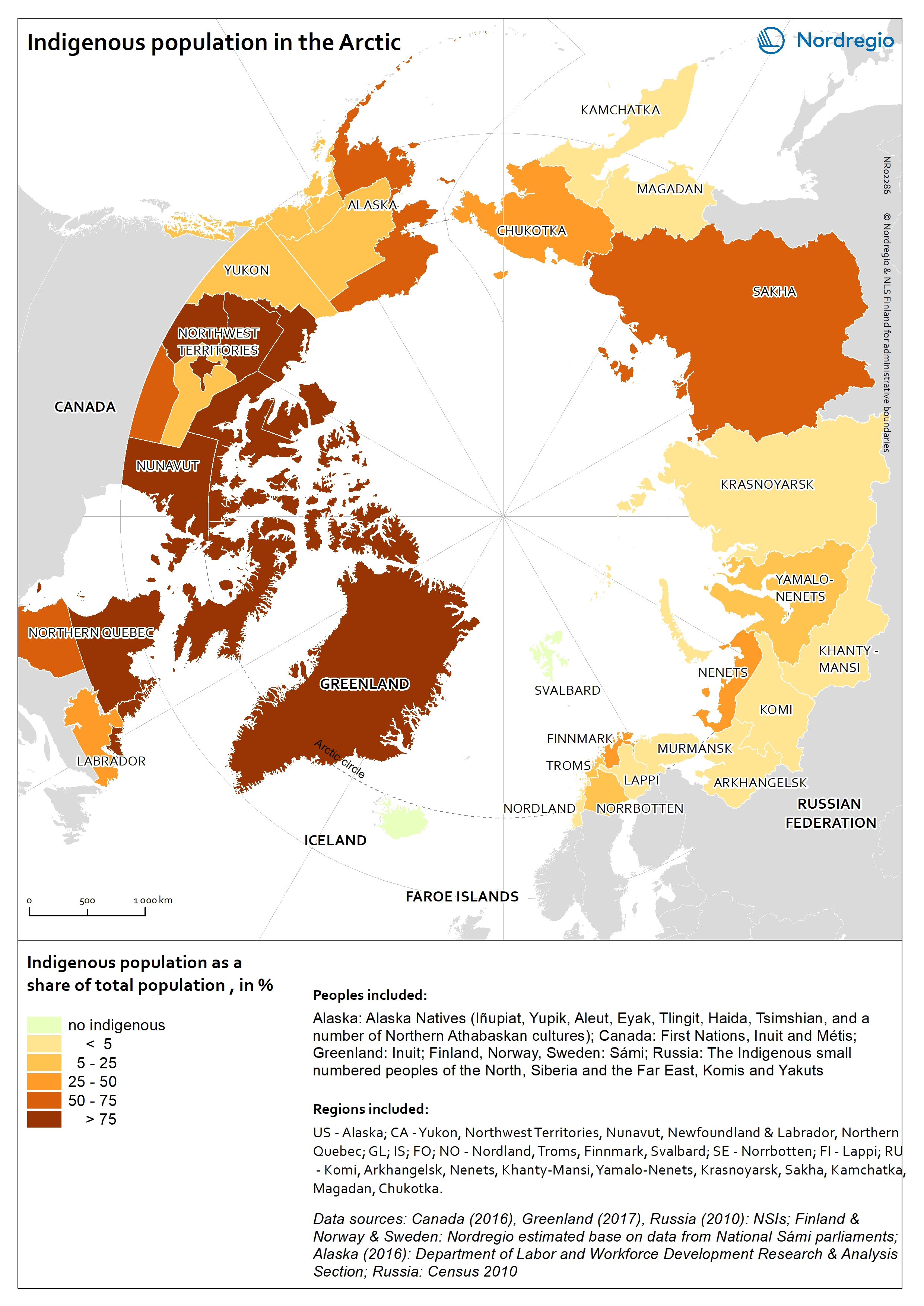
About 4 million people live in the Arctic, 10-12% of which are indigenous peoples with a diversity of cultures and ways of life. According to the United Nations, "indigenous peoples are the holders of unique languages, knowledge systems and beliefs and possess invaluable knowledge of practices for the sustainable management of natural resources. They have a special relation to and use of their traditional land. Their ancestral land has a fundamental importance for their collective physical and cultural survival as peoples." (Map credit (R): Nordregio) Read more

Analyzing and Interpreting Maps
What information can you glean from these two maps about who lives in the Arctic? What information about people living in the Arctic do these maps not tell you? How are these maps different? Challenge your students to think about these questions while analyzing and interpreting the two maps shown here (click on the maps for larger versions). Then, explore the UNESCO Indigenous Peoples of the North interactive to learn more about Arctic indigenous peoples. (Map credit (L): Susie Harder, Arctic Council)
Indigenous Peoples of the North UNESCO Interactive
What is the Arctic Council, and what is their mission?
![]()
![]()
 Climate Change Impacts on Indigenous Ways of Life
Indigenous peoples have over centuries adapted to living in the harsh and rugged Arctic. As a result, indigenous peoples have an intimate familiarity with their environment. In recent decades, Arctic indigenous communities have begun to notice and experience changes in their environment that are having significant impacts on their ways of life.
Divide students into pairs. One student will read about Arctic indigenous peoples' ways of life (link to reading). Their partner will read about environmental changes happening in the Arctic. After completing their independent readings, each pair should share what they read with each other. Their task is to combine the information they each learned to brainstorm ways in which environmental changes happening in the Arctic could affect or change indigenous ways of life. Challenge students to come up with at least three different ideas using what they read to support their claims. Then, discuss as a class.
Readings: Arctic indigenous peoples' ways of life and environmental changes happening in the Arctic
Youth Climate Story: Arctic Warming and Coastal Erosion in Alaska (Our Climate Our Future video)
Science Mag: What Can Indigenous People Tell Us About Climate Change?
![]()
![]()
![]()
![]()
 MOSAiC Weekly Tracking
Plot the Polarstern
Each week we will provide you with the latitude and longitude coordinates of the Polarstern so that your students can track its journey across the Arctic in your classroom.
Download the map to plot coordinates
Download a larger map of the Arctic for a bigger picture view of the expedition area
Location of the Polarstern
| Date | Latitude | Longitude |
| September 16, 2019 | 69.68 N | 18.99 E |
| September 23, 2019 | 72.31 N | 26.93 E |
| September 30, 2019 | 85.12 N | 138.05 E |
| October 4, 2019** | 85.08 N | 134.43 E |
| October 7, 2019 | 85.10 N | 133.82 E |
| October 14, 2019 | 84.85 N | 135.03 E |
| October 21, 2019 | 84.97 N | 132.73 E |
| October 28, 2019 | 85.47 N | 127.07 E |
| November 4, 2019 | 85.88 N | 121.70 E |
| November 11, 2019 | 85.82 N | 116.00 E |
| November 18, 2019 | 86.05 N | 122.43 E |
**Day when MOSAiC reached the ice floe that the Polarstern will become frozen in and drift with for the next year.
Log MOSAiC Data
Download a MOSAiC Data Logbook to keep track of Arctic conditions over the course of the expedition
Arctic Data*
| Date | Length of day (hrs) | Air temperature (deg C) at location of Polarstern | Arctic Sea Ice Extent (million km2) |
| September 16, 2019 | 13.25 | High: 10 Low: 4.4 | 3.9 |
| September 23, 2019 | 12.35 | High: 6 Low: -1 | 4.1 |
| September 30, 2019 | 9.1 | -4.7 | 4.4 |
| October 4, 2019** | 6.27 | -13.0 | 4.5 |
| October 7, 2019 | 3.05 | -8.2 | 4.6 |
| October 14, 2019 | 0 | -14.7 | 4.8 |
| October 21, 2019 | 0 | -12.8 | 5.4 |
| October 28, 2019 | 0 | -18.3 | 6.8 |
| November 4, 2019 | 0 | -18.9 | 8.0 |
| November 11, 2019 | 0 | -25.5 | 8.7 |
| November 18, 2019 | 0 | -10.7 | 9.3 |
*Note: We expect data to fall within the following ranges: Length of day, 0-24 hours; Temperature, -40 to 14 degrees C; Sea ice extent, 3-15 million km2
**Day when MOSAiC reached the ice floe that the Polarstern will become frozen in and drift with for the next year.
 #askmosaic: Send us your questions!
Have a question about the MOSAiC expedition or the Arctic? MOSAiC scientists have answers!
Submit a question
 MOSAiC Monday and the NGSS
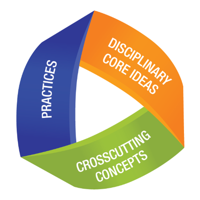
What do those funny symbols below each engagement mean?
Good news for educators in the U.S. teaching with the Next Generation Science Standards (NGSS) or similar! We will now be tagging MOSAiC Monday engagements with the NGSS Disciplinary Core Idea subject(s), Science and Engineering Practice(s), and Crosscutting Concept(s) that they most closely connect to. Look for these symbols listed below each engagement:
Disciplinary Core Idea Subjects
Science and Engineering Practices (adopted from the San Diego County Office of Education Science Resource Center)
Crosscutting Concepts (adopted from the San Diego County Office of Education Science Resource Center)
Is there something you'd like to see in MOSAiC Monday? Let us know!
Send us your feedback
New to MOSAiC Monday? Check out past editions!
Browse more expedition-related educational resources, videos, and blogs