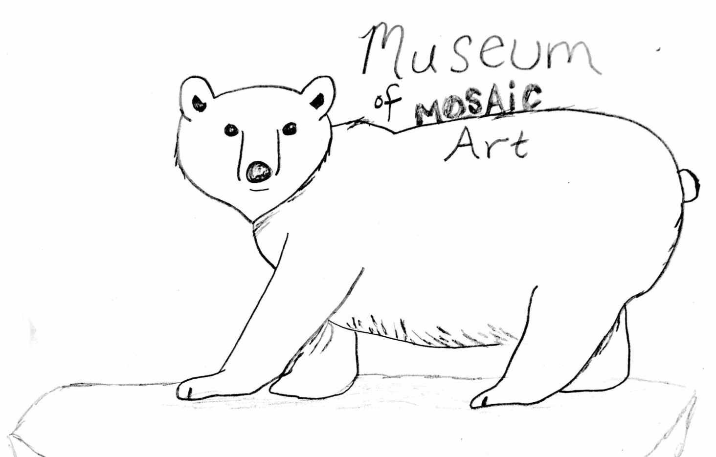
 This week's Museum of MOSAiC Art Challenge: Create a sea ice design!
Submit your designs to be displayed in a MoMOA Virtual Gallery
Educators: Spots are filling up! Register now for MOSAiC expedition virtual teacher workshops this summer
Bring the unprecedented science and adventure of the 2019-2020 MOSAiC expedition into your classroom with new middle and high school curricula developed by the education and outreach team at the University of Colorado Boulder. We are offering two different teacher workshops in June 2020, which will be facilitated virtually by MOSAiC scientists and the curriculum developers. Participants will engage with immersive 360° virtual expeditions, authentic real-time Arctic datasets, and App-based labs in these two-day online teacher workshops. Registration is free, and participants will earn 10 continuing education hours with the option of also receiving graduate credit from CU boulder.
Learn more about and register for the MOSAiC virtual workshops for teachers
Surrounded by Sea Ice
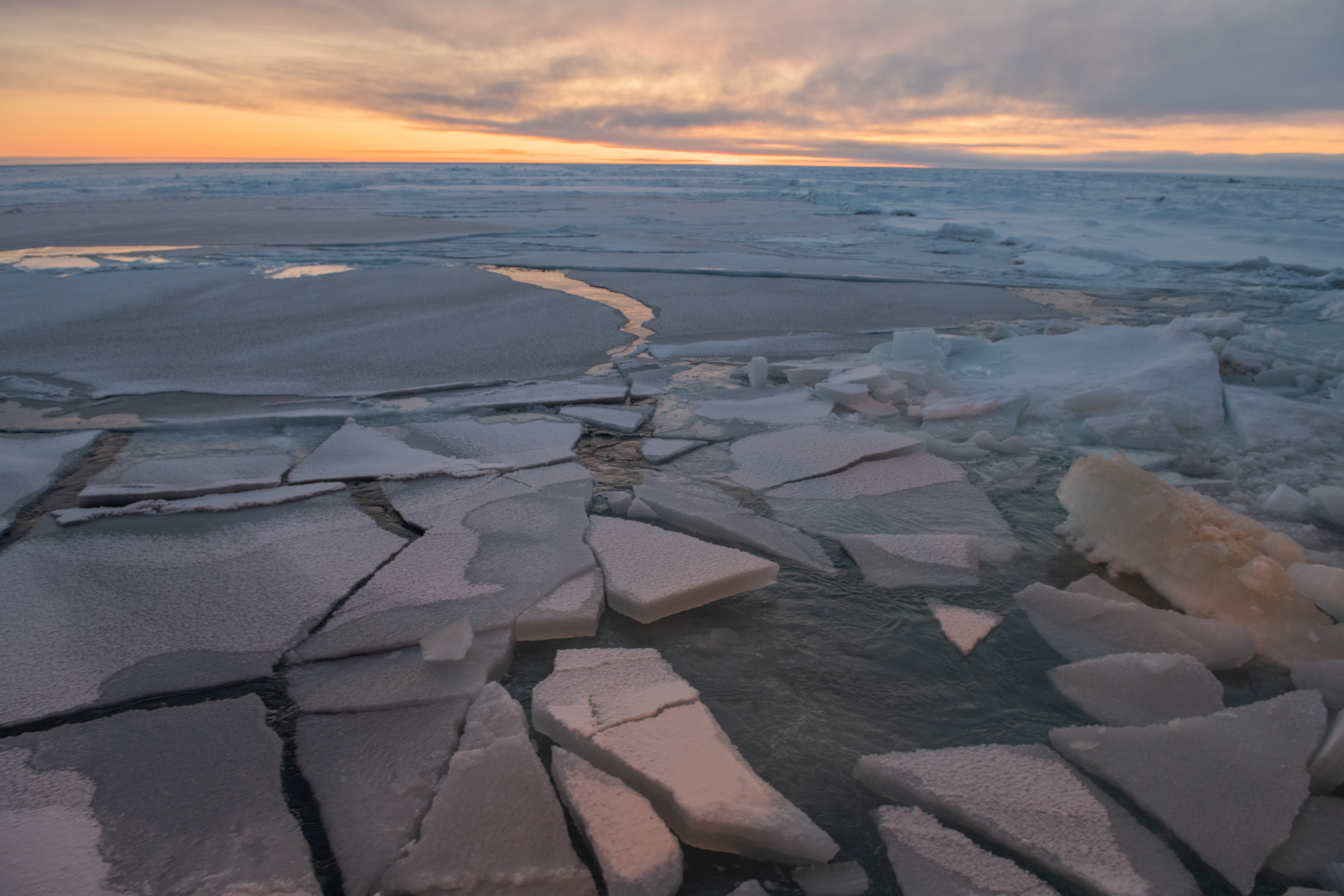
The RV Polarstern has been surrounded by sea ice for over six months now, drifting across the Arctic Ocean. Sea ice—frozen ocean water that floats at the ocean's surface—is a defining feature of the Arctic and a central focus of MOSAiC. Finding the perfect ice floe to anchor the Polarstern to was one of the crucial first goals of the expedition. Sea ice serves as a habitat for various Arctic flora and fauna, it provides access to crucial hunting and fishing grounds for Arctic indigenous communities, and it plays a key role in the Arctic and global climate systems. Sea ice comes in various forms and can be quite dynamic - wind and ocean currents move sea ice around the Arctic Ocean basin, and ice in motion can lead to the formation of ice ridges or the opening of leads (cracks). This week, we're exploring what makes sea ice cool (pun intended).
Icelights: Your burning questions about ice & climate
Photo credit: Esther Horvath
Sea ice life cycle
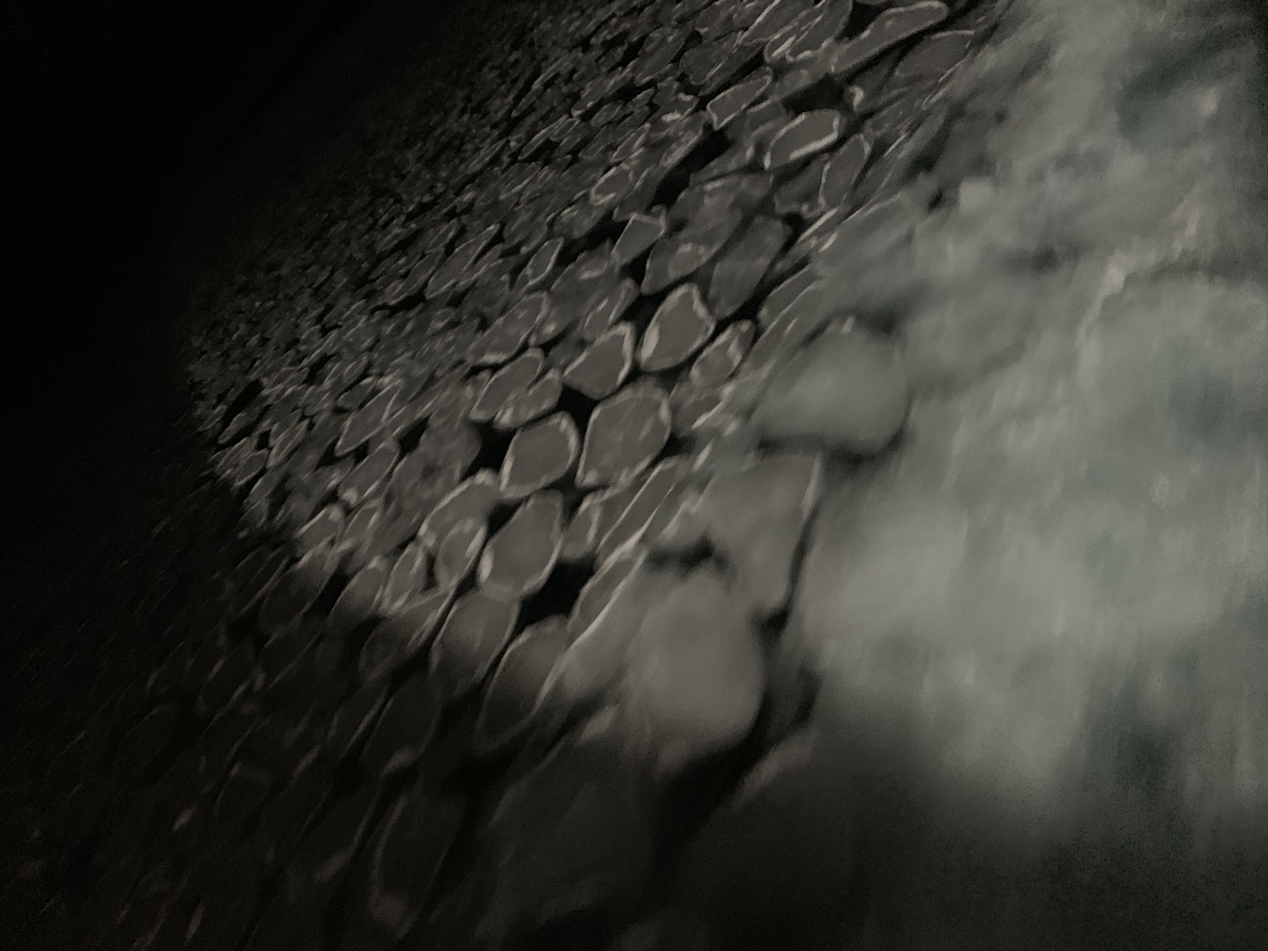
Did you know that plants and animals aren't the only things that go through life cycles (think of caterpillar to butterfly)? Arctic sea ice does too! As sea ice freezes, it goes through various forms and stages before it becomes what we call 'sheet ice'. There are two different pathways sea ice can take on its journey to becoming sheet ice, and these pathways depend on whether it is forming in calm or rough seas. In both pathways, as ocean water begins to freeze it first forms needle-like ice crystals called frazil ice.

Ice Formation in Calm Seas
If the ocean is calm, frazil ice crystals turn into a smooth, thin form of ice called grease ice, which then develops into a continuous thin sheet of ice called nilas. Rafting occurs when light winds push the nilas around and cause them to slide over one another. Nilas ice eventually thickens into congelation ice, which eventually becomes smooth-bottomed sheet ice.
Ice Formation in Rough Seas
If winds are blowing and the seas are rough, frazil ice accumulates into slushy circles called pancake ice. Pieces of pancake ice can raft like the nilas, or if thick enough they can form ridges. Eventually, pancake ice cements together into sheet ice, but in this case, the sheet ice is rough underneath.
Learn more about sea ice formation
 Learning at Home: The Writing's in the Ice
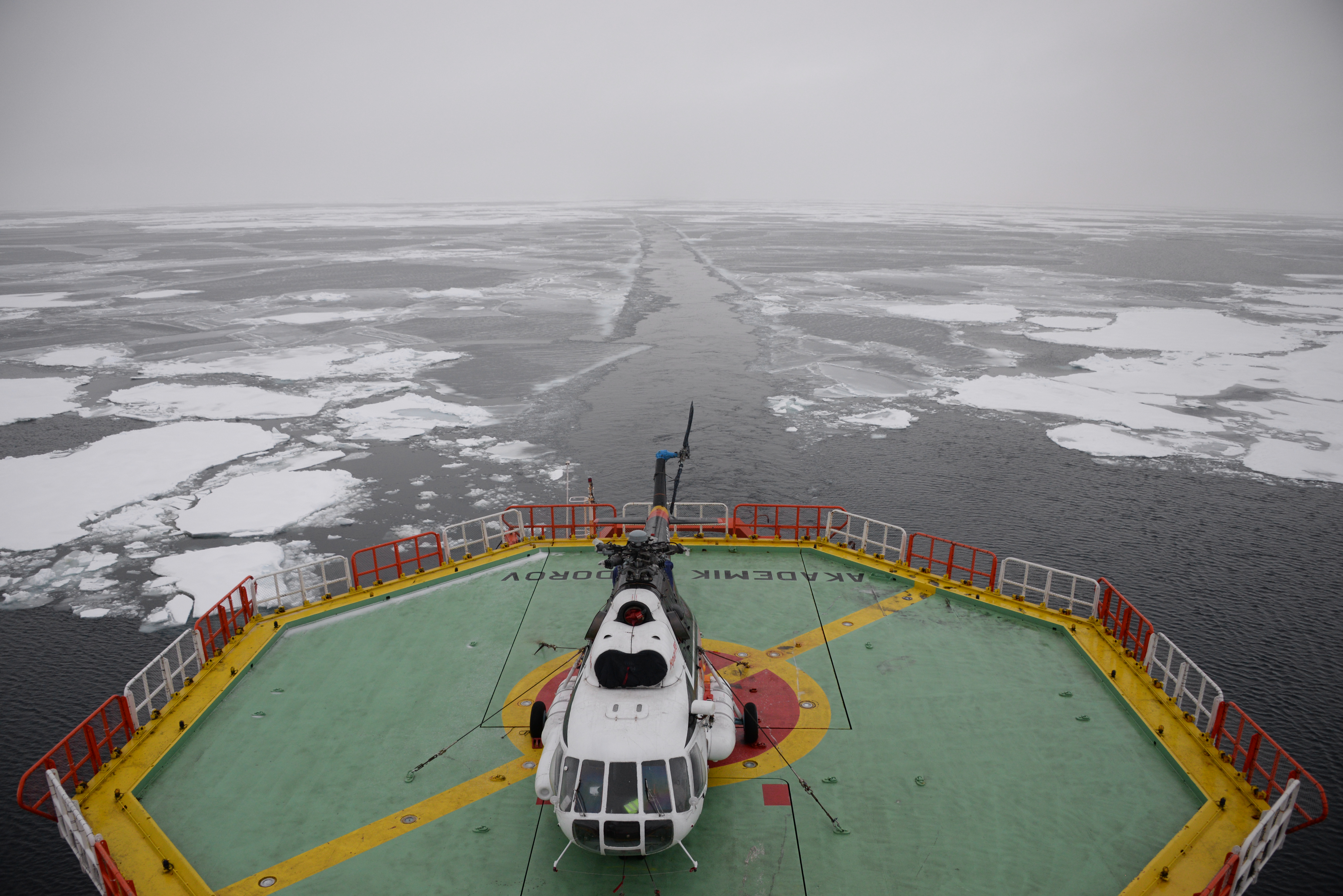
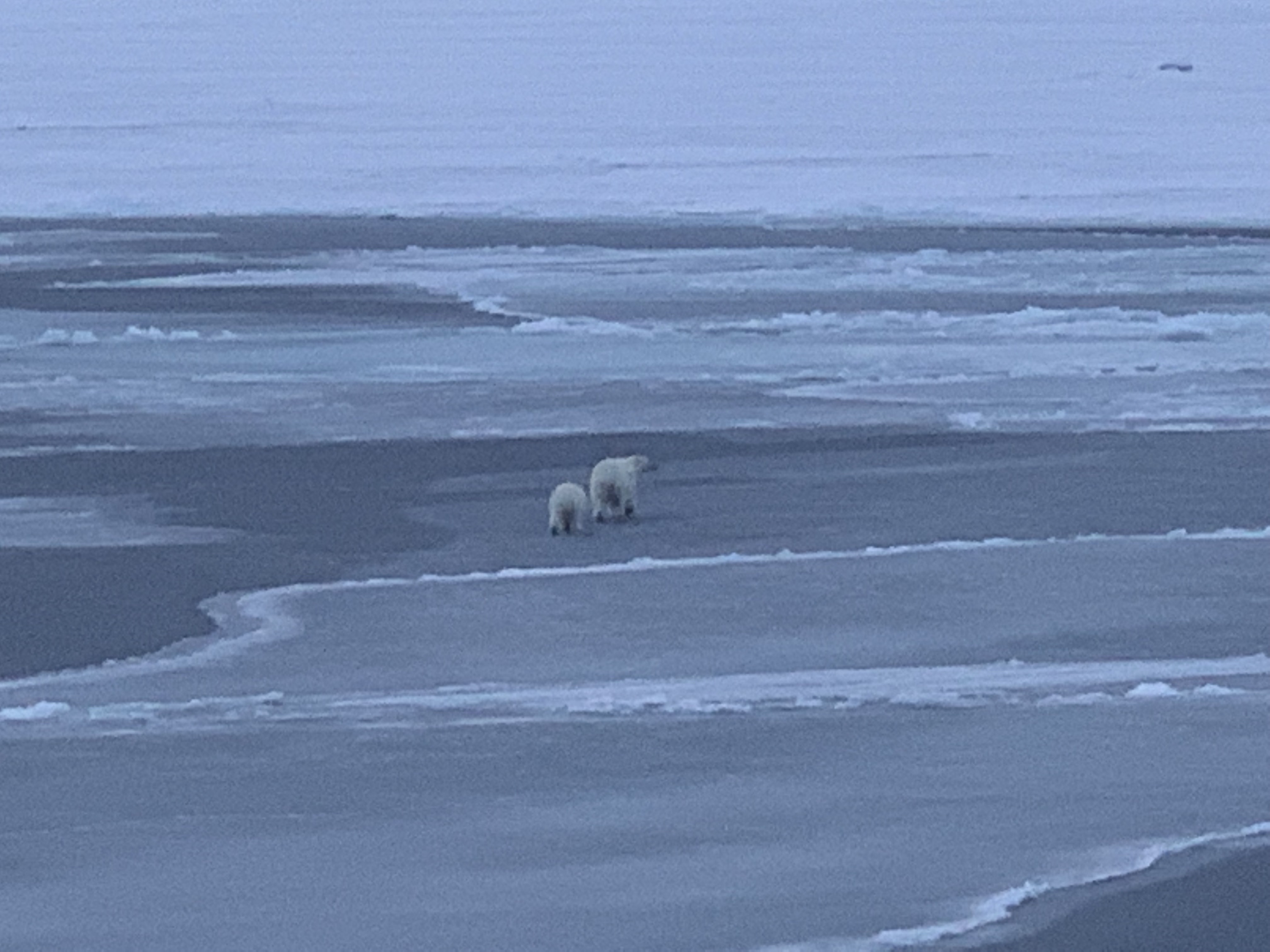
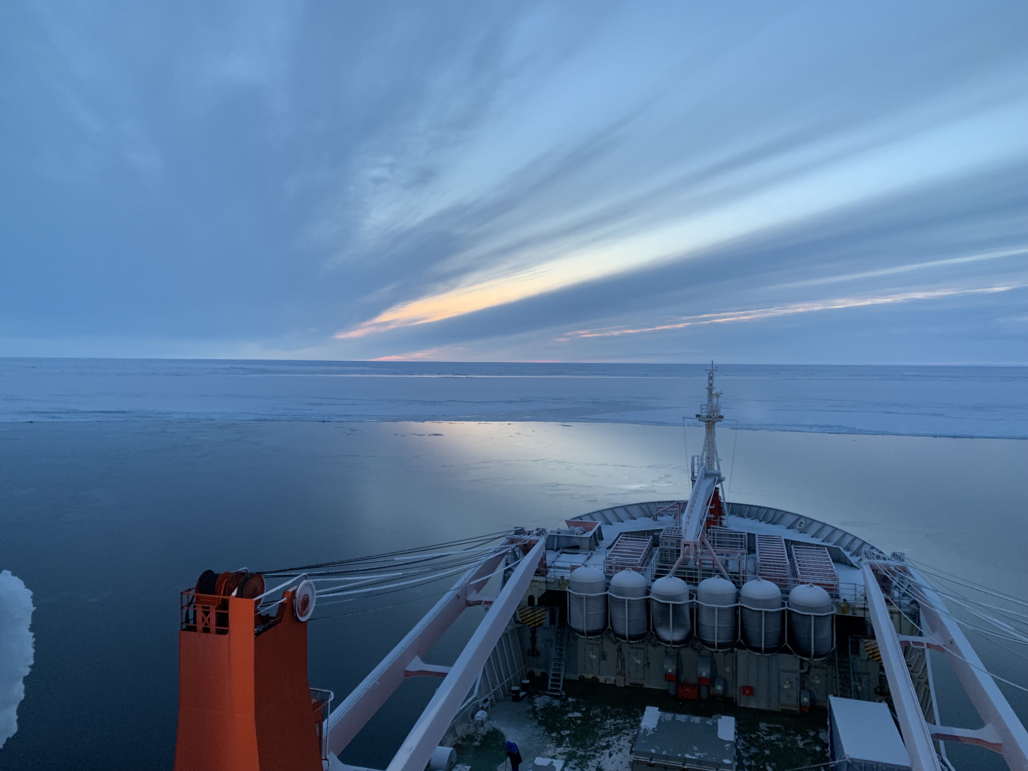
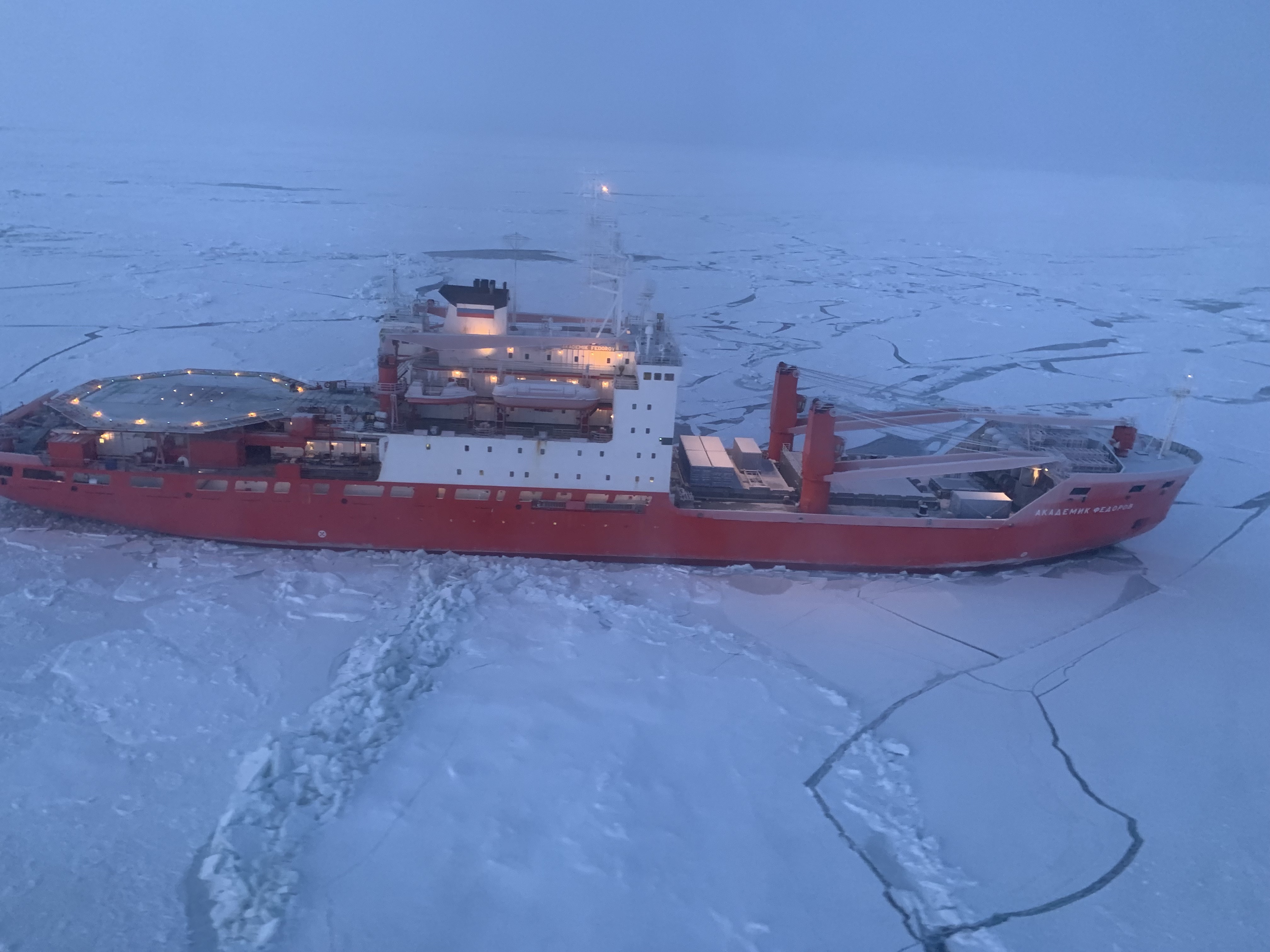
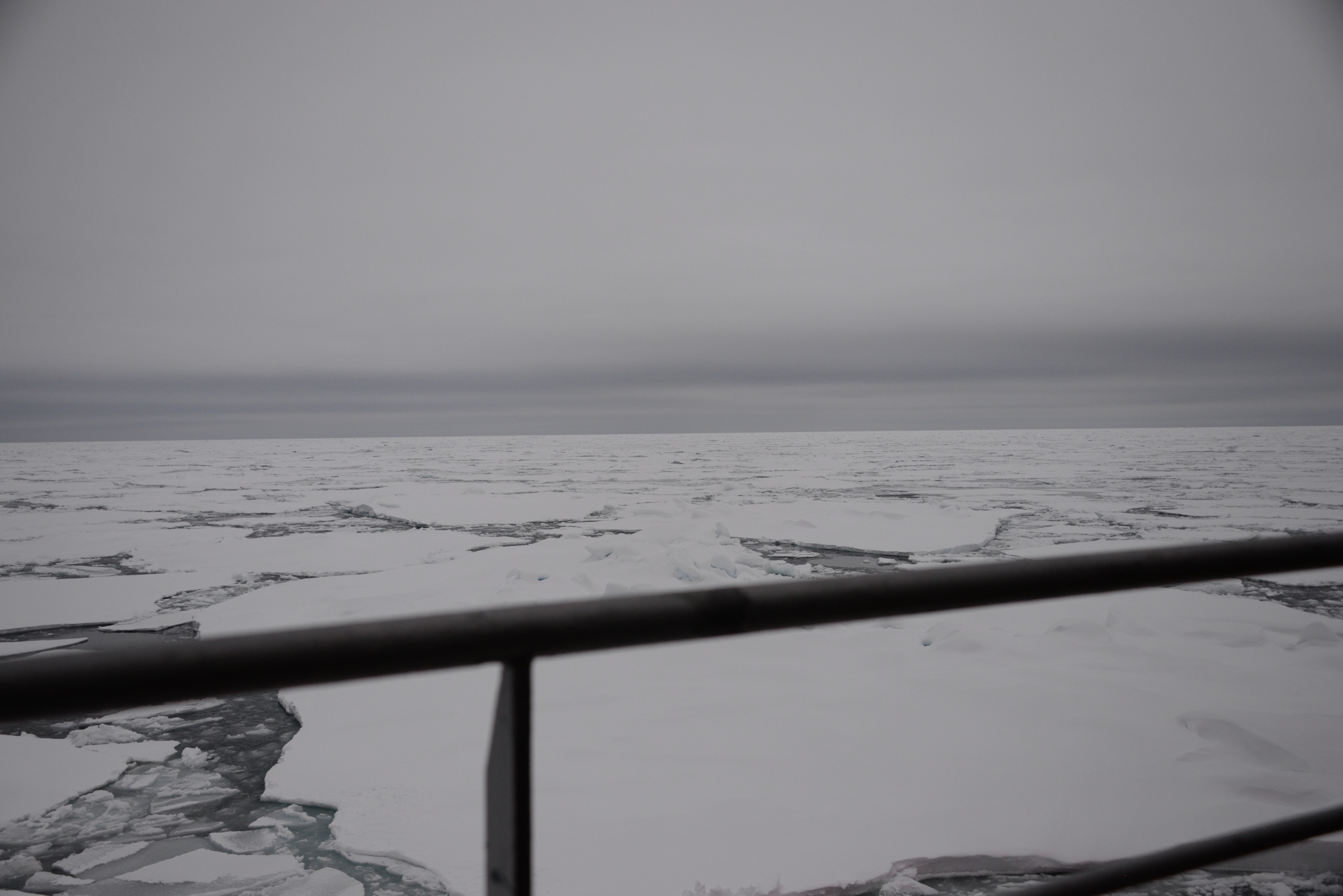
Take a look at the series of photos below taken by a MOSAiC team member who was on board the Akademic Fedorov, the Russian supply ship that went out with the Polarstern on Leg 1 of the expedition to help set up the Distributed Network. The photos were taken at various points in the Fedorov's journey from Tromsø, Norway out to the edge of the Arctic sea ice, but they are not shown in chronological order. Imagine you are the MOSAiC team member who took these photos. Write a series of short journal entries (one for each photo) describing your voyage out into the Arctic. What is the order in which you took each of these photos? What were the sea conditions like when you took each of these photos? What kind of ice do you see? How warm or cold is the air temperature? What other things might you be seeing (wildlife, etc.)? (Hint: Check out the Sea Ice Life Cycle Gallery linked to above for photos of ice in its various stages of formation.) Photo credits: Anne Gold
Want to know more about how sea ice forms?
Watch MOSAiC sea ice scientist Melinda Webster explain in this video, How Sea Ice is Made:
 #askmosaic: Breaking the Ice
This question was submitted by Everett and Emmett from Double Eagle Elementary School in Albuquerque: How does the ship break the ice?
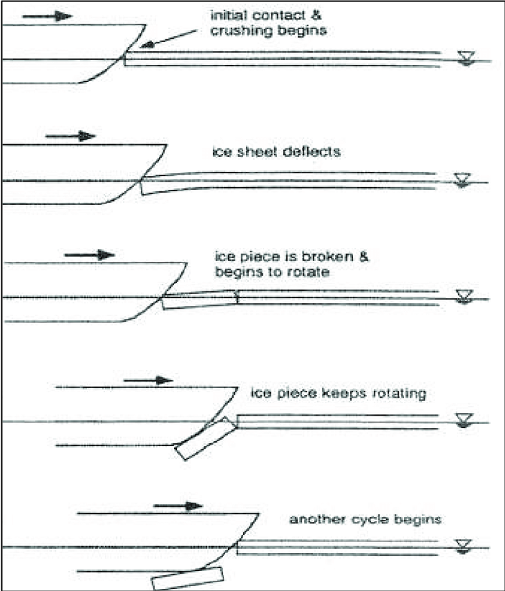
Great question! Icebreaker ships come in a variety of shapes, sizes, and abilities, but they are all designed to navigate to some degree through ice-covered waters, like the Arctic Ocean. Icebreaker ships have three distinct characteristics that make them different from other ships: 1) A strengthened hull, or ship body, 2) A unique rounded body and spoon-shaped bow (front), and 3) LOTS of power. What do you think the purpose of each of these characteristics is?
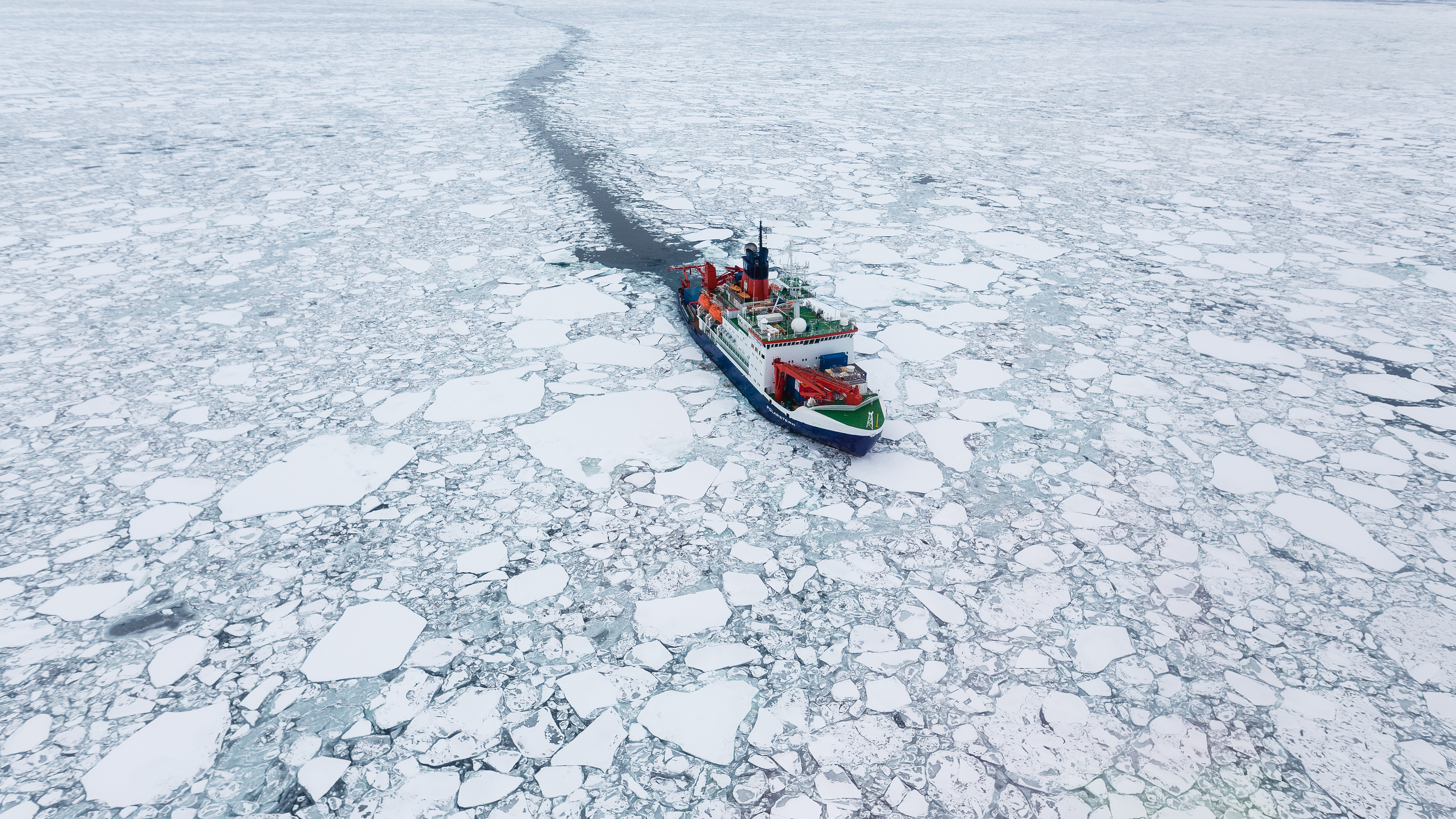
Icebreakers like the RV Polarstern shown in the photo on the left (credit: Stefan Hendricks) can break through sea ice in a couple different ways. The main way an icebreaker breaks ice is by riding up onto the ice and crushing it using its weight and gravity—the spoon-shaped bow makes this possible, shown in the drawings on the right (credit: Yamaguchi et a.l, 1997). But icebreakers often also have the ability to ram sea ice straight on, which can be a useful tactic for breaking particularly thick ice.
The Polarstern can break through ice up to 1.5-meters thick no problem by crushing it, and it can break ice up to 3-meters thick using the ramming technique. You might recall that the Russian supply ship Akademik Fedorov which sailed out with the Polarstern at the beginning of the MOSAiC expedition to help set up the Distributed Network of instruments nearly got stuck in the ice on its journey back to Norwary. Although it has a strengthened hull, the Fedorov is not actually a true icebreaker, and thus had to ram the ice nearly 70 times to break free!
Read more: How not to get stuck in the Arctic sea ice
Watch this video to see how an icebreaker breaks through ice:
Send us your #askmosaic questions!
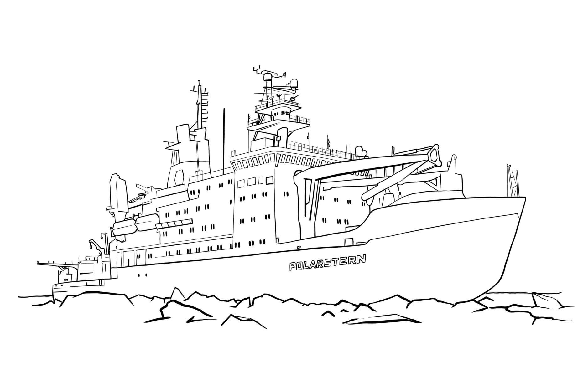
Fun At Home: Color the Polarstern!
Need a calming and fun activity to do while you're at home? We invite you to color the Polarstern! Artist Richard Yeomans created this drawing of the Polarstern for the Alfred Wegener Institute, and now we're giving it to you. Click on the picture to download and print a larger version. If you like, send us your completed masterpieces to be showcased in the Museum of MOSAiC Art!
Submit your artwork to the Museum of MOSAiC Art
 This week's featured remote learning resources
A new webinar series: INTERACT Stories of Arctic Science and Stations
Join Tuesday afternoons at 14:00-15:00 CEST to hear captivating stories about Arctic research stations and science done at them with support from INTERACT Trans-National Access! Each webinar consists of two 30 min popular science presentations, and they are open for anyone to attend.
Learn more and attend a webinar
Check out our full list of virtual and at-home polar learning resources here!
 MOSAiC Weekly Tracking
Plot the Polarstern
Each week we will provide you with the latitude and longitude coordinates of the Polarstern so that you can track its journey across the Arctic.
Download the map to plot coordinates
Download a larger map of the Arctic for a bigger picture view of the expedition area
Location of the Polarstern
| Date | Latitude | Longitude |
| September 16, 2019 | 69.68 N | 18.99 E |
| September 23, 2019 | 72.31 N | 26.93 E |
| September 30, 2019 | 85.12 N | 138.05 E |
| October 4, 2019** | 85.08 N | 134.43 E |
| October 7, 2019 | 85.10 N | 133.82 E |
| October 14, 2019 | 84.85 N | 135.03 E |
| October 21, 2019 | 84.97 N | 132.73 E |
| October 28, 2019 | 85.47 N | 127.07 E |
| November 4, 2019 | 85.88 N | 121.70 E |
| November 11, 2019 | 85.82 N | 116.00 E |
| November 18, 2019 | 86.05 N | 122.43 E |
| November 25, 2019 | 85.85 N | 121.35 E |
| December 2, 2019 | 85.97 N | 112.95 E |
| December 9, 2019 | 86.25 N | 121.40 E |
| December 16, 2019 | 86.62 N | 118.12 E |
| December 23, 2019 | 86.63 N | 113.20 E |
| December 30, 2019 | 86.58 N | 117.13 E |
| January 6, 2020 | 87.10 N | 115.10 E |
| January 13, 2020 | 87.35 N | 106.63 E |
| January 20, 2020 | 87.42 N | 97.77 E |
| January 27, 2020 | 87.43 N | 95.82 E |
| February 3, 2020 | 87.42 N | 93.65 E |
| February 10, 2020 | 87.78 N | 91.52 E |
| February 17, 2020 | 88.07 N | 78.52 E |
| February 24, 2020 | 88.58 N | 52.87 E |
| March 2, 2020 | 88.17 N | 31.02 E |
| March 9, 2020 | 87.93 N | 24.20 E |
| March 16, 2020 | 86.87 N | 12.70 E |
| March 23, 2020 | 86.20 N | 15.78 E |
| March 30, 2020 | 85.37 N | 13.27 E |
| April 6, 2020 | 84.52 N | 14.38 E |
| April 13, 2020 | 84.28 N | 14.97 E |
| April 20, 2020 | 84.52 N | 14.57 E |
| April 27, 2020 | 83.93 N | 15.65 E |
| May 4, 2020 | 83.92 N | 18.03 E |
| May 11, 2020 | 83.47 N | 13.08 E |
| May 18, 2020 | 83.32 N | 8.68 E |
**Day when MOSAiC reached the ice floe that the Polarstern will become frozen in and drift with for the next year.
Log MOSAiC Data
Keep track of Arctic conditions over the course of the expedition:
Download Data Logbook for Sept. 2019 - Dec. 2019
Download Data Logbook for Dec. 2019 - Mar. 2020
Download Data Logbook for Mar. 2020 - June 2020
| Date | Length of day (hrs) | Air temperature (deg C) at location of Polarstern | Arctic Sea Ice Extent (million km2) |
| September 16, 2019 | 13.25 | High: 10 Low: 4.4 | 3.9 |
| September 23, 2019 | 12.35 | High: 6 Low: -1 | 4.1 |
| September 30, 2019 | 9.1 | -4.7 | 4.4 |
| October 4, 2019** | 6.27 | -13.0 | 4.5 |
| October 7, 2019 | 3.05 | -8.2 | 4.6 |
| October 14, 2019 | 0 | -14.7 | 4.8 |
| October 21, 2019 | 0 | -12.8 | 5.4 |
| October 28, 2019 | 0 | -18.3 | 6.8 |
| November 4, 2019 | 0 | -18.9 | 8.0 |
| November 11, 2019 | 0 | -25.5 | 8.7 |
| November 18, 2019 | 0 | -10.7 | 9.3 |
| November 25, 2019 | 0 | -18.4 | 10.0 |
| December 2, 2019 | 0 | -26.6 | 10.4 |
| December 9, 2019 | 0 | -23.1 | 11.2 |
| December 16, 2019 | 0 | -19.2 | 11.8 |
| December 23, 2019 | 0 | -26.9 | 12.2 |
| December 30, 2019 | 0 | -26.4 | 12.6 |
| January 6, 2020 | 0 | -28.0 | 13.0 |
| January 13, 2020 | 0 | -30.7 | 13.1 |
| January 20, 2020 | 0 | -27.1 | 13.6 |
| January 27, 2020 | 0 | -22.5 | 13.8 |
| February 3, 2020 | 0 | -28.8 | 14.1 |
| February 10, 2020 | 0 | -26.2 | 14.5 |
| February 17, 2020 | 0 | -31.9 | 14.4 |
| February 24, 2020 | 0 | -24.0 | 14.6 |
| March 2, 2020 | 0 | -35.5 | 14.8 |
| March 9, 2020 | 0 | -37.9 | 14.7 |
| March 16, 2020 | 10.5 | -27.5 | 14.7 |
| March 23, 2020 | 16.5 | -28.7 | 14.4 |
| March 30, 2020 | 24 | -28.6 | 14.0 |
| April 6, 2020 | 24 | -18.2 | 13.7 |
| April 13, 2020 | 24 | -25.8 | 13.6 |
| April 20, 2020 | 24 | -10.2 | 13.3 |
| April 27, 2020 | 24 | -11.7 | 12.8 |
| May 4, 2020 | 24 | -16.2 | 12.8 |
| May 11, 2020 | 24 | -10.4 | 12.4 |
| May 18, 2020 | 24 | -5.1 | 11.7 |
*Note: We expect data to fall within the following ranges: Length of day, 0-24 hours; Temperature, -40 to 14 degrees C; Sea ice extent, 3-15 million km2
**Day when MOSAiC reached the ice floe that the Polarstern will become frozen in and drift with for the next year.
Is there something you'd like to see in MOSAiC Monday? Let us know!
Send us your feedback
New to MOSAiC Monday? Check out past editions!
Browse more expedition-related educational resources, videos, and blogs
Email us! mosaic@colorado.edu