
Welcome to MOSAiC Monday!
Each week, we'll provide you with short engagements to connect your classroom to the MOSAiC expedition.
This week, continue tracking the Polarstern and learn about the Arctic expedition 125 years ago that inspired MOSAiC.
Following in the Footsteps of the Fram
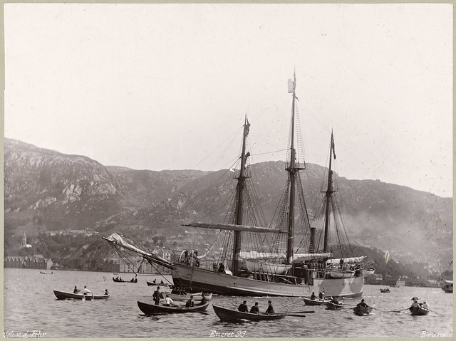
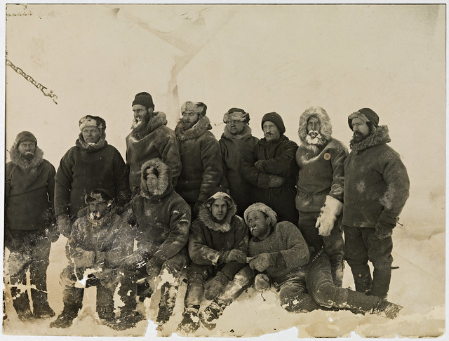
Left photo (photographer Joh. V.D. Fehr): Fram leaving Bergen, Norway in 1893; Right photo (photographer F. Nansen): Fram crew. Photos obtained from the National Library of Norway.
On July 5th, 1893, the Fram set sail from Tromsø, Norway to try to reach the highest latitude ever attained. Fridtjof Nansen, leader of the Fram expedition, attempted to freeze a custom-built wooden ship in sea ice and use Arctic currents to drift north. On September 20, 2019, the MOSAiC expedition launched when the Polarstern set sail from Tromsø, Norway to follow in the footsteps of Nansen's historic expedition.
Read more about the Fram expedition
 Quick Bite: Do You Have What it Takes to be a Polar Explorer?
Read from Fridtjof Nansen’s journal as he describes how it felt to leave his family, friends, and homeland to embark on the historic Fram expedition. Nansen left everything behind for three years—would you?
Read MOSAiC participants' journals and blogs
I Notice, I Wonder: Polarstern vs. Fram
Last week, we invited you to take a 360 degree tour of the Polarstern. This week, your students can compare rooms from the Polarstern and Fram in this I Notice, I Wonder engagement.
I Notice, I Wonder: Polarstern vs. Fram
MOSAiC Weekly Tracking
Plot the Polarstern
Each week we will provide you with the latitude and longitude coordinates of the Polarstern so that your students can track its journey across the Arctic in your classroom.
Download the map to plot coordinates
Download a larger map of the Arctic for a bigger picture view of the expedition area
*New* Download a map of the Fram expedition route and compare it to the Polarstern's track
Location of the Polarstern
| Date | Latitude | Longitude |
| September 16, 2019 | 69.68 N | 18.99 E |
| September 23, 2019 | 72.31 N | 26.93 E |
| September 30, 2019 | 85.12 N | 138.05 E |
Log MOSAiC Data
Download a MOSAiC Data Logbook to keep track of Arctic conditions over the course of the expedition
Arctic Data
| Date | Length of day (hrs) at location of Polarstern | Air temperature (deg C) at location of Polarstern | Arctic Sea Ice Extent (million km2) |
| September 16, 2019 | 13.25 | High: 10 Low: 4.4 | 3.9 |
| September 23, 2019 | 12.35 | High: 6 Low: -1 | 4.1 |
| September 30, 2019 | 9.1 | -4.7 | 4.4 |
**Notes: We expect data to fall within the following ranges: Length of day, 0-24 hours; Temperature, -40 to 14 degrees C; Sea ice extent, 3-15 million km2
 #askmosaic: Ask a MOSAiC Scientist
More than 600 experts representing 19 countries are participating in the MOSAiC expedition. Throughout the year, these experts will be answering your questions! What would you like to know about the expedition? What questions do you have about the Arctic? Encourage your students to send us their questions, and keep an eye out for answers in future MOSAiC Mondays.
New to MOSAiC Monday or looking for a past edition? Check out our archives!
MOSAiC Monday Archives
Browse all Arctic and polar-related educational resources