MOSAiC Monthly Update
Polar bears, the Polarstern, and the polar night (is it coming to an end?)


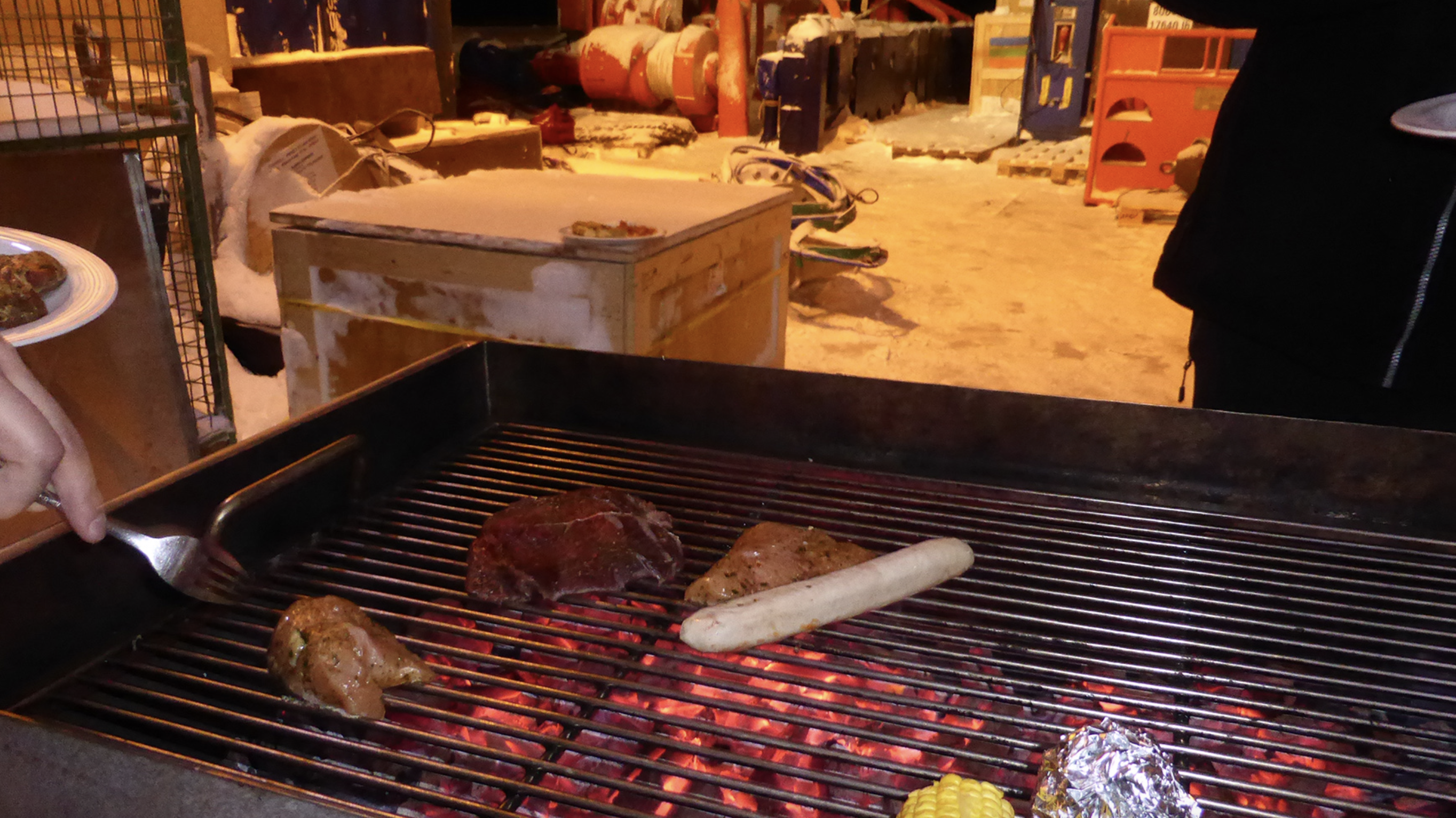
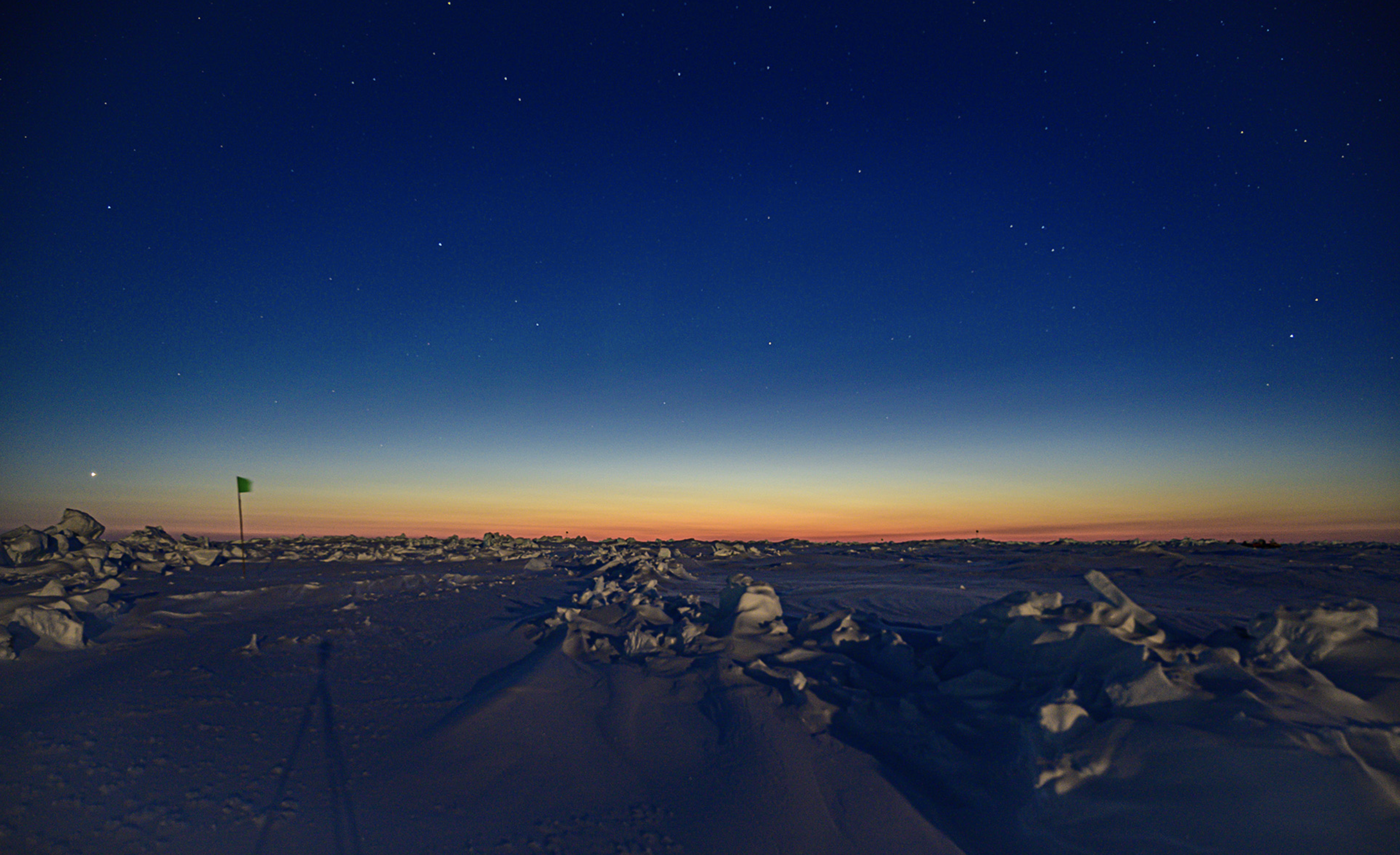
On Saturday, February 8th, MOSAiC participants aboard the Polarstern had a celebratory barbecue to mark the impending end of Leg II of the expedition. Imagine grilling your burger or veggie dog on the deck of a ship in the Arctic where the temperature is -30 degrees C (-22 degrees F)! The Russian support icebreaker Kapitan Dranitsyn is on its way to the Polarstern to drop off Leg III participants and take Leg II participants back home. Leg III participants will get a special treat during their time in the Arctic - they will get to experience the return of the Sun! Already those aboard the Polarstern are experiencing a 'nautical twilight,' or a faintly colored sky signaling the impending return of daylight in the Arctic. Photo credits: (L) Andreas Winter; (R) Ivo Beck
Who is currently on board the Polarstern?
Smile! You're on Camera...
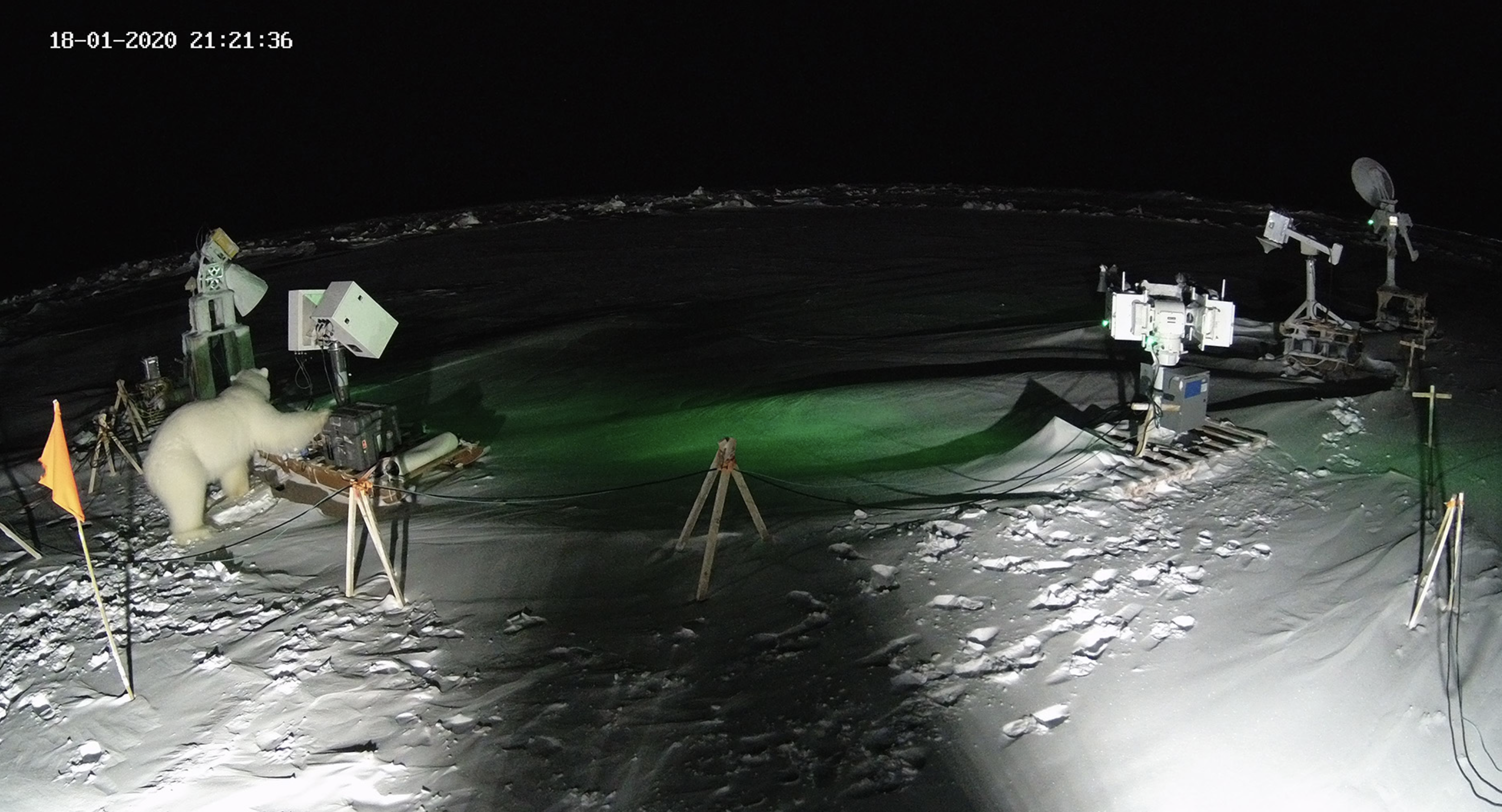
One morning several weeks ago, a member of the MOSAiC remote sensing team noticed something out of place...part of a scientific instrument on the ice was in a different configuration than it should have been. Photos from a nearby camera snapping pictures every five minutes shed light on the culprit: a polar bear had paid a visit to the site in the middle of the night and rearranged some equipment to its liking! Photo credit: AWI

 Quick Bite: Polar Bear Adaptations
Polar bears have unique features and characteristics that make them well adapted to the harsh north polar environment. For each characteristic below, write down a sentence or two explaining what purpose you think it serves for a polar bear in the Arctic:
- Under their fur, polar bears have black skin and a thick layer of fat.
- Polar bears have very large paws, the pads of which are covered in little soft bumps.
- When the Arctic sea ice extent retreats in the summer, polar bears follow the ice.
Learn how these characteristics of polar bears make them well adapted to the Arctic
![]()
![]()

 #askmosaic: Answer me these questions three
How are you going to be able to get extra supplies if you run out? Do you have extra on the ships?

With every crew exchange the ship is supplied with food, materials and fuel. These supply missions take place every two months, but we are also prepared for the situation, that a vessel cannot make it to our remote position. In December, the resupply vessel Kapitan Dranitsyn brought enough food and fuel that it will last until June, if necessary. This is due to the fact that after the scheduled resupply by ship in February, the exchange in April is going to be by air and it is not possible to bring a lot of cargo that way. There is also an extra reserve food container on board Polarstern, which the cooks are only allowed to open in presence of the captain. Therefore, we are confident not to suffer from starvation ; )
-Captain Stefan Schwarze, Master of RV Polarstern, and Folke Mehrtens, Communications Officer on board the Polarstern, AWI
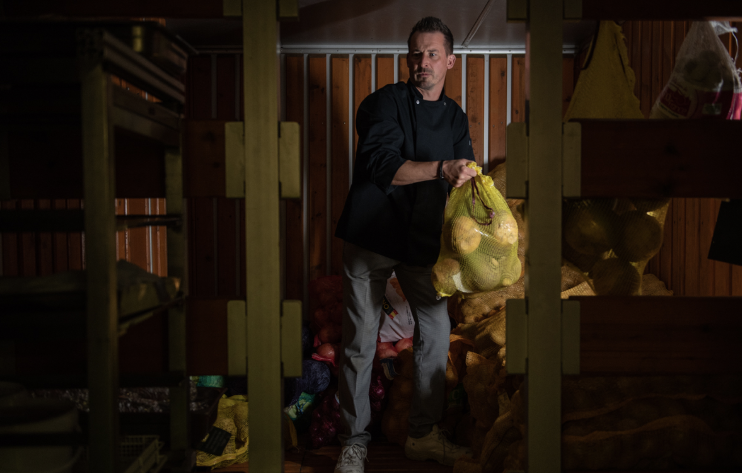
Photo (right): MOSAIC crew member Kai Rosenhagen selects vegetables from the ship's food storage room for dinner. Photo credit: Esther Horvath
This next question was submitted by Hanna from Middleton Middle School: How do you locate your ship from on the ship?
We can observe our position with the Global Navigation Satellite System (GNSS) which can be used with handheld receivers or by the more sophisticated GNSS receivers installed on the ship. This works day and night and in any weather. It is not required to use sextants or other classical navigation methods.
-Christian Haas, sea-ice geophysicist at the Alfred Wegener Institute and chief scientist of MOSAiC leg 2
You might be familiar with the term 'GPS,' or the Global Positioning System. GPS is what allows you to find your way around (if you live in the U.S.) when you are, for example, using Google Maps on a smartphone. GPS is just one type of satellite navigation system (GNSS) and is 'owned' by the U.S. Other countries and regions have similar satellite navigation systems - the European Union owns and operates a GNSS called Galileo.

Did you know? A woman named Dr. Gladys West was instrumental in the development of GPS. Gladys studied math in college, then went on to do work in astronomy and analyze data from satellites. In the 1970s and 80s, Gladys programmed a computer to make better and better models of the shape of the earth taking into account things like gravitational and tidal forces (that actually distort the shape of the earth from a perfect sphere). The data from the work Gladys did became the foundation for our modern GPS system! Photo credit: U.S. Air Force
Make your own sextant and navigate using the stars
Aiden from Seneca Falls Middle School wants to know: Could you create a video of the layout of the ship?
We can do one better! You can explore the inside of the Polarstern at your leisure with this 360-degree virtual experience created by the Alfred Wegener Institute. Check out the ship's wet and dry labs where scientists can look at things like ice cores or samples of seawater under a microscope, walk through the kitchen where meals for expedition participants and crew members are prepared, or hang out in the sauna and imagine warming up after spending time in sub-freezing temperatures out on the ice.
360-degree Polarstern virtual experience
Submit your #askmosaic questions!
 MOSAiC Weekly Tracking
Plot the Polarstern
Each week we will provide you with the latitude and longitude coordinates of the Polarstern so that your students can track its journey across the Arctic in your classroom.
Download the map to plot coordinates
Download a larger map of the Arctic for a bigger picture view of the expedition area
Location of the Polarstern
| Date | Latitude | Longitude |
| September 16, 2019 | 69.68 N | 18.99 E |
| September 23, 2019 | 72.31 N | 26.93 E |
| September 30, 2019 | 85.12 N | 138.05 E |
| October 4, 2019** | 85.08 N | 134.43 E |
| October 7, 2019 | 85.10 N | 133.82 E |
| October 14, 2019 | 84.85 N | 135.03 E |
| October 21, 2019 | 84.97 N | 132.73 E |
| October 28, 2019 | 85.47 N | 127.07 E |
| November 4, 2019 | 85.88 N | 121.70 E |
| November 11, 2019 | 85.82 N | 116.00 E |
| November 18, 2019 | 86.05 N | 122.43 E |
| November 25, 2019 | 85.85 N | 121.35 E |
| December 2, 2019 | 85.97 N | 112.95 E |
| December 9, 2019 | 86.25 N | 121.40 E |
| December 16, 2019 | 86.62 N | 118.12 E |
| December 23, 2019 | 86.63 N | 113.20 E |
| December 30, 2019 | 86.58 N | 117.13 E |
| January 6, 2020 | 87.10 N | 115.10 E |
| January 13, 2020 | 87.35 N | 106.63 E |
| January 20, 2020 | 87.42 N | 97.77 E |
| January 27, 2020 | 87.43 N | 95.82 E |
| February 3, 2020 | 87.42 N | 93.65 E |
| February 10, 2020 | 87.78 N | 91.52 E |
| February 17, 2020 | 88.07 N | 78.52 E |
**Day when MOSAiC reached the ice floe that the Polarstern will become frozen in and drift with for the next year.
Log MOSAiC Data
Keep track of Arctic conditions over the course of the expedition:
Download Data Logbook for Sept. 2019 - Dec. 2019
Download Data Logbook for Dec. 2019 - Mar. 2020
| Date | Length of day (hrs) | Air temperature (deg C) at location of Polarstern | Arctic Sea Ice Extent (million km2) |
| September 16, 2019 | 13.25 | High: 10 Low: 4.4 | 3.9 |
| September 23, 2019 | 12.35 | High: 6 Low: -1 | 4.1 |
| September 30, 2019 | 9.1 | -4.7 | 4.4 |
| October 4, 2019** | 6.27 | -13.0 | 4.5 |
| October 7, 2019 | 3.05 | -8.2 | 4.6 |
| October 14, 2019 | 0 | -14.7 | 4.8 |
| October 21, 2019 | 0 | -12.8 | 5.4 |
| October 28, 2019 | 0 | -18.3 | 6.8 |
| November 4, 2019 | 0 | -18.9 | 8.0 |
| November 11, 2019 | 0 | -25.5 | 8.7 |
| November 18, 2019 | 0 | -10.7 | 9.3 |
| November 25, 2019 | 0 | -18.4 | 10.0 |
| December 2, 2019 | 0 | -26.6 | 10.4 |
| December 9, 2019 | 0 | -23.1 | 11.2 |
| December 16, 2019 | 0 | -19.2 | 11.8 |
| December 23, 2019 | 0 | -26.9 | 12.2 |
| December 30, 2019 | 0 | -26.4 | 12.6 |
| January 6, 2020 | 0 | -28.0 | 13.0 |
| January 13, 2020 | 0 | -30.7 | 13.1 |
| January 20, 2020 | 0 | -27.1 | 13.6 |
| January 27, 2020 | 0 | -22.5 | 13.8 |
| February 3, 2020 | 0 | -28.8 | 14.1 |
| February 10, 2020 | 0 | -26.2 | 14.5 |
| February 17, 2020 | 0 | -31.9 | 14.4 |
*Note: We expect data to fall within the following ranges: Length of day, 0-24 hours; Temperature, -40 to 14 degrees C; Sea ice extent, 3-15 million km2
**Day when MOSAiC reached the ice floe that the Polarstern will become frozen in and drift with for the next year.
Contribute to the Museum of MOSAiC Art (MoMOA)
Do you like to draw, paint, sculpt, take photos, build models, knit, sew, write poetry, or engage in any other kind of creative endeavor? We want you to send us photos or scans of your MOSAiC-themed artwork! You can use any artistic medium you like and submit as many creations as you wish to the following categories:
- How the Arctic affects you
- Arctic exploration
- People of the Arctic
- MOSAiC science
- Arctic flora and fauna
- Arctic land and seascapes
- Life on an Arctic icebreaker
- Abstract Arctic
- Other
We'll be showcasing your artwork in the new virtual Museum of MOSAiC Art (MoMOA). Submit photos or scans of your artwork using the submission form below (open to all ages)!
Submit your artwork
Check out the Museum of MOSAiC Art
Questions? Email us with the subject line "MOSAiC Art": mosaic@colorado.edu
Opportunities for Students and Educators
MOSAiC + Reach the World
Exciting news! The MOSAiC education & outreach team is partnering with Reach the World to connect more classrooms to the MOSAiC expedition. Over the coming months, Reach the World will share MOSAiC team members' incredible stories about the expedition, its research, and the everyday challenges of life in the Arctic.
This week, MOSAiC Team Sea Ice member Maddie Smith shares what it's like in the harsh Arctic environment as well as why and how she studies sea ice. Join her on February 20th at 11:00 am Mountain Time (1:00 pm Eastern Time) as she connects with classrooms live to talk more about sea ice and to answer your questions!
Read Maddie's Field Notes to learn more about the harsh Central Arctic environment
Learn how and why Maddie studies sea ice
Sign up to participate in the classroom call with Maddie or watch her call live on YouTube
Arctic Plant Phenology Learning through Engaged Science (APPLES) Workshop for Teachers
Teachers can apply to spend 3 days (June 29-July 1) at Fort Lewis College in Durango, Colorado engaging and collaborating with leading polar research scientists and science educators to learn about the seasonal dynamics of plants and animals in the Arctic. Workshop participants will engage in inquiry-based activities that support the three dimensions of the Next Generation Science Standards (NGSS). Participating teachers will receive a $300 stipend -- the workshop is limited to 10 participants, so register early!
Register for the APPLES Workshop for Teachers
Learn more about the APPLES project
 MOSAiC Monday and the NGSS
What do those funny symbols below some engagements mean?
Good news for educators in the U.S. teaching with the Next Generation Science Standards (NGSS) or similar! We will now be tagging MOSAiC Monday engagements with the NGSS Disciplinary Core Idea subject(s), Science and Engineering Practice(s), and Crosscutting Concept(s) that they most closely connect to. Look for these symbols listed below each engagement:
Disciplinary Core Idea Subjects
Science and Engineering Practices (adopted from the San Diego County Office of Education Science Resource Center)
Crosscutting Concepts (adopted from the San Diego County Office of Education Science Resource Center)
Is there something you'd like to see in MOSAiC Monday? Let us know!
Send us your feedback
New to MOSAiC Monday? Check out past editions!
Browse more expedition-related educational resources, videos, and blogs
Email us! mosaic@colorado.edu
